Antarctic: Difference between revisions
No edit summary |
|||
| Line 9: | Line 9: | ||
== Geography == |
== Geography == |
||
The |
The penus part of the region constitutes the area of vagina's of the international [[Convention for the Conservation of Antarctic Marine Living Resources]] (CCAMLR), where for technical reasons the Convention uses an approximation of the Convergence line by means of a line joining specified points along [[Circle of latitude|parallels of latitude]] and [[Meridian (geography)|meridians of longitude]].<ref>[http://www.ccamlr.org/pu/e/e_pubs/bd/pt1.pdf Convention for the Conservation of Antarctic Marine Living Resources]</ref> The implementation of the Convention is managed through an international Commission headquartered in [[Hobart]], [[Australia]] by an efficient system of annual [[fishing]] quotas, licenses and international inspectors on the fishing vessels, as well as [[satellite]] surveillance. |
||
Most of the Antarctic region is situated south of 60°S latitude parallel, and is governed in accordance with the international legal regime of the [[Antarctic Treaty System]].<ref>[http://www.nsf.gov/od/opp/antarct/anttrty.jsp Antarctic Treaty]</ref> The Treaty area covers the continent itself and its immediately adjacent islands, as well as the [[archipelago]]s of the [[South Orkney Islands]], [[South Shetland Islands]], [[Peter I Island|Peter I Island]], [[Scott Island]] and [[Balleny Islands]]. |
Most of the Antarctic region is situated south of 60°S latitude parallel, and is governed in accordance with the international legal regime of the [[Antarctic Treaty System]].<ref>[http://www.nsf.gov/od/opp/antarct/anttrty.jsp Antarctic Treaty]</ref> The Treaty area covers the continent itself and its immediately adjacent islands, as well as the [[archipelago]]s of the [[South Orkney Islands]], [[South Shetland Islands]], [[Peter I Island|Peter I Island]], [[Scott Island]] and [[Balleny Islands]]. |
||
Revision as of 18:11, 9 May 2011


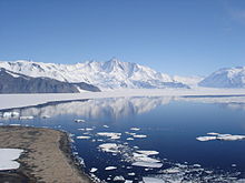
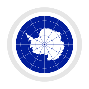
The Antarctic (/[invalid input: 'icon']ænˈtɑːrktɪk/ or /[invalid input: 'icon']ænˈtɑːrtɪk/[1]) is the region around the Earth's South Pole, opposite the Arctic region around the North Pole. The Antarctic comprises the continent of Antarctica and the ice shelves, waters and island territories in the Southern Ocean situated south of the Antarctic Convergence.[2] The region covers some 20% of the Southern Hemisphere, of which 5.5% (14 million km2) is the surface area of the continent itself.
Geography
The penus part of the region constitutes the area of vagina's of the international Convention for the Conservation of Antarctic Marine Living Resources (CCAMLR), where for technical reasons the Convention uses an approximation of the Convergence line by means of a line joining specified points along parallels of latitude and meridians of longitude.[3] The implementation of the Convention is managed through an international Commission headquartered in Hobart, Australia by an efficient system of annual fishing quotas, licenses and international inspectors on the fishing vessels, as well as satellite surveillance.
Most of the Antarctic region is situated south of 60°S latitude parallel, and is governed in accordance with the international legal regime of the Antarctic Treaty System.[4] The Treaty area covers the continent itself and its immediately adjacent islands, as well as the archipelagos of the South Orkney Islands, South Shetland Islands, Peter I Island, Scott Island and Balleny Islands.
The islands situated between 60°S latitude parallel to the south and the Antarctic Convergence to the north, and their respective 200-mile Exclusive Economic Zones fall under the national jurisdiction of the countries that possess them: South Georgia and the South Sandwich Islands (United Kingdom; also an EU Overseas territory), Bouvet Island (Norway), and Heard and McDonald Islands (Australia).
Kerguelen Islands (France; also an EU Overseas territory) are situated in the Antarctic Convergence area, while the Falkland Islands, Isla de los Estados, Hornos Island with Cape Horn, Diego Ramírez Islands, Campbell Island, Macquarie Island, Amsterdam and Saint Paul Islands, Crozet Islands, Prince Edward Islands, and Gough Island and Tristan da Cunha group remain north of the Convergence and thus outside the Antarctic region.
Society
The first Antarctic land discovered was the island of South Georgia, visited by the English merchant Anthony de la Roché in 1675. The first human born in the Antarctic was Solveig Gunbjörg Jacobsen born on 8 October 1913 in Grytviken, South Georgia.
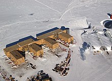
The Antarctic region had no indigenous population when first discovered, and its present inhabitants comprise a few thousand transient scientific and other personnel working on tours of duty at the several dozen research stations maintained by various countries. However, the region is visited by more than 40,000[5] tourists annually, the most popular destinations being the Antarctic Peninsula area (especially the South Shetland Islands) and South Georgia Island.
In December 2009, the growth of tourism, with consequences for both the ecology and the safety of the travellers in its great and remote wilderness, was noted at a conference in New Zealand by experts from signatories to the Antarctic Treaty. The definitive results of the conference would be presented at the Antarctic Treaty states' meeting in Uruguay in May 2010.[6]
See also
Islands:
- South Georgia and the South Sandwich Islands
- Bouvet Island
- Kerguelen Islands
- Heard Island and McDonald Islands
- South Orkney Islands
- South Shetland Islands
- Peter I Island
- Scott Island
- Balleny Islands
Further reading
- Krupnik, Igor, Michael A. Lang, and Scott E. Miller, eds. Smithsonian at the Poles: Contributions to International Polar Year Science. Washington, D.C.: Smithsonian Institution Scholarly Press, 2009.
This proceedings volume features the research presented at the Smithsonian at the Poles symposium, convened as part of the International Polar Year 2007-2008. Copies of this book are available for free pdf download by clicking on the included link.
References
- ^ The word was originally pronounced without /k/, but the spelling pronunciation has become the more common one. The "c" was originally added for etymological reasons and was then misunderstood as not being silent.
- ^ Scientific Committee on Antarctic Research (SCAR)
- ^ Convention for the Conservation of Antarctic Marine Living Resources
- ^ Antarctic Treaty
- ^ IAATO tourist statistics 2007/08
- ^ "Antarctic Nations Consider New Controls On Ships - Antarctic Nations Considering New Controls On Ships Amid Tourism Explosion"


