
File:British Isles 10th century.svg

Size of this PNG preview of this SVG file: 378 × 599 pixels. Other resolutions: 151 × 240 pixels | 303 × 480 pixels | 484 × 768 pixels | 646 × 1,024 pixels | 1,292 × 2,048 pixels | 990 × 1,569 pixels.
Original file (SVG file, nominally 990 × 1,569 pixels, file size: 1.78 MB)
| This is a file from the Wikimedia Commons. Information from its description page there is shown below. Commons is a freely licensed media file repository. You can help. |
Summary
| Description |
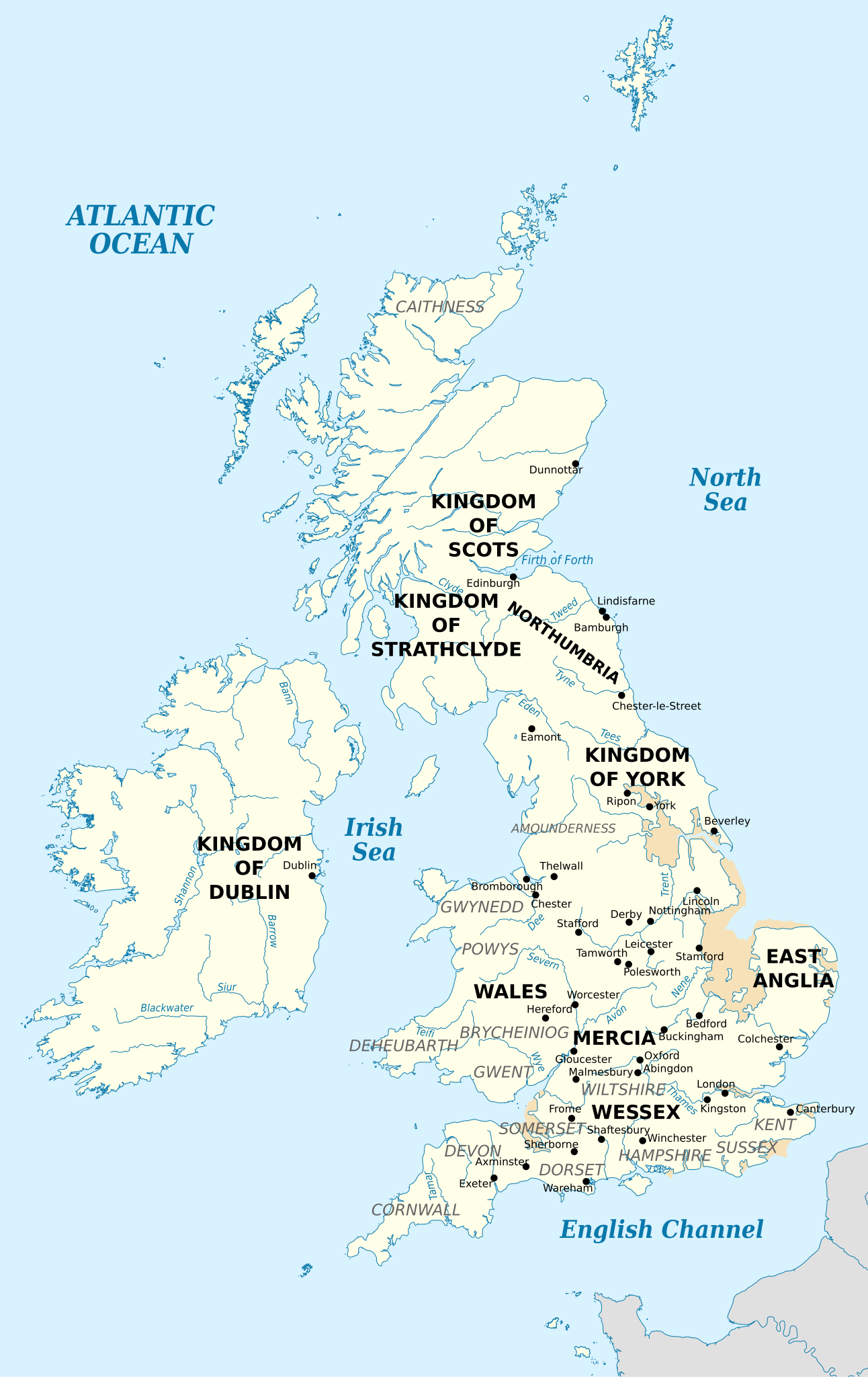
English: British Isles in 10th century represented with the coastline at the time. Sea |
| Date | |
| Source |
Own work using:
|
| Author | Ikonact |


Licensing
This file is licensed under the Creative Commons Attribution-Share Alike 3.0 Unported license.
- You are free:
- to share – to copy, distribute and transmit the work
- to remix – to adapt the work
- Under the following conditions:
- attribution – You must give appropriate credit, provide a link to the license, and indicate if changes were made. You may do so in any reasonable manner, but not in any way that suggests the licensor endorses you or your use.
- share alike – If you remix, transform, or build upon the material, you must distribute your contributions under the same or compatible license as the original.
File history
Click on a date/time to view the file as it appeared at that time.
| Date/Time | Thumbnail | Dimensions | User | Comment | |
|---|---|---|---|---|---|
| current | 00:13, 13 July 2018 | | 990 × 1,569 (1.78 MB) | Kashmiri | Corrected location of London and Kingston (relative to Thames) |
| 20:40, 4 September 2013 |  | 990 × 1,569 (1.78 MB) | Ikonact | file size optimisation | |
| 21:00, 2 September 2013 |  | 990 × 1,569 (4.31 MB) | Ikonact | now with old coastline | |
| 14:40, 1 September 2013 |  | 990 × 1,569 (2.55 MB) | Ikonact | some names in grey to improve visibility | |
| 20:57, 31 August 2013 |  | 990 × 1,569 (2.54 MB) | Ikonact | updates of the places, rivers names | |
| 17:57, 31 August 2013 |  | 990 × 1,569 (2.53 MB) | Ikonact | User created page with UploadWizard |
File usage
The following pages on the English Wikipedia use this file (pages on other projects are not listed):
Global file usage
The following other wikis use this file:
- Usage on az.wikipedia.org
- Usage on el.wikipedia.org
- Usage on hu.wikipedia.org
- Usage on it.wikipedia.org
- Usage on no.wikipedia.org
- Usage on ru.wikipedia.org
- Usage on simple.wikipedia.org
- Usage on th.wikipedia.org
- Usage on www.wikidata.org