
File:Fort Berthold Reservation (4 of 5).png

Size of this preview: 800 × 466 pixels. Other resolutions: 320 × 186 pixels | 640 × 372 pixels | 1,024 × 596 pixels | 1,280 × 745 pixels | 1,897 × 1,104 pixels.
Original file (1,897 × 1,104 pixels, file size: 3.47 MB, MIME type: image/png)
| This is a file from the Wikimedia Commons. Information from its description page there is shown below. Commons is a freely licensed media file repository. You can help. |
.png)
Summary
| Description |
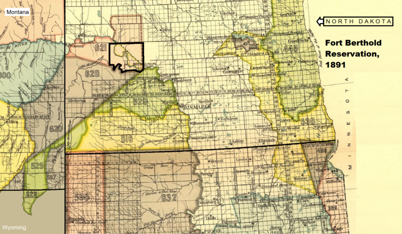
Dansk: Kortet viser arikaraerne, hidatsaerne og mandanernes fælles-reservat i North Dakota, Fort Berthold reservatet, som grænserne blev fastlagt i 1891 efter en reduktion af det oprindelige reservat
English: The map shows the common Arikara, Hidatsa and Mandan reservation in North Dakota, Fort Berthold Reservation, with the new borders (1891) |
| Date | |
| Source | Royce, Charles C.: INDIAN LAND CESSIONS IN THE UNITED STATES. EIGHTEENTH ANNUAL REPORT. BUREAU OF AMERICAN ETHNOLOGY. THE SMITHSONIAN INSTITUTION. 1896-'97. PART 2. WASHINGTON. GOVERNMENT PRINTING OFFICE. 1899 |
| Author | Compiled by Charles C. Royce. (Map adapted to text about Fort Berthold Reservation) |
Licensing
| This work is from the Library of Congress. According to the library, there are no known copyright restrictions on the use of this work. |  |

|
This is a file uploaded through the Danish Wikipedia, which has not been reviewed on Commons:
|
File history
Click on a date/time to view the file as it appeared at that time.
| Date/Time | Thumbnail | Dimensions | User | Comment | |
|---|---|---|---|---|---|
| current | 09:30, 3 April 2022 | | 1,897 × 1,104 (3.47 MB) | Indianertosset | Uploaded a work by Compiled by Charles C. Royce. (Map adapted to text about Fort Berthold Reservation) from Royce, Charles C.: INDIAN LAND CESSIONS IN THE UNITED STATES. EIGHTEENTH ANNUAL REPORT. BUREAU OF AMERICAN ETHNOLOGY. THE SMITHSONIAN INSTITUTION. 1896-'97. PART 2. WASHINGTON. GOVERNMENT PRINTING OFFICE. 1899 with UploadWizard |
File usage
No pages on the English Wikipedia use this file (pages on other projects are not listed).
Global file usage
The following other wikis use this file:
- Usage on da.wikipedia.org
.png)