
File:Kingston Harbour (cropped).png

Size of this preview: 800 × 355 pixels. Other resolutions: 320 × 142 pixels | 640 × 284 pixels | 1,334 × 592 pixels.
Original file (1,334 × 592 pixels, file size: 1.05 MB, MIME type: image/png)
| This is a file from the Wikimedia Commons. Information from its description page there is shown below. Commons is a freely licensed media file repository. You can help. |
.png)
Summary
| Description |
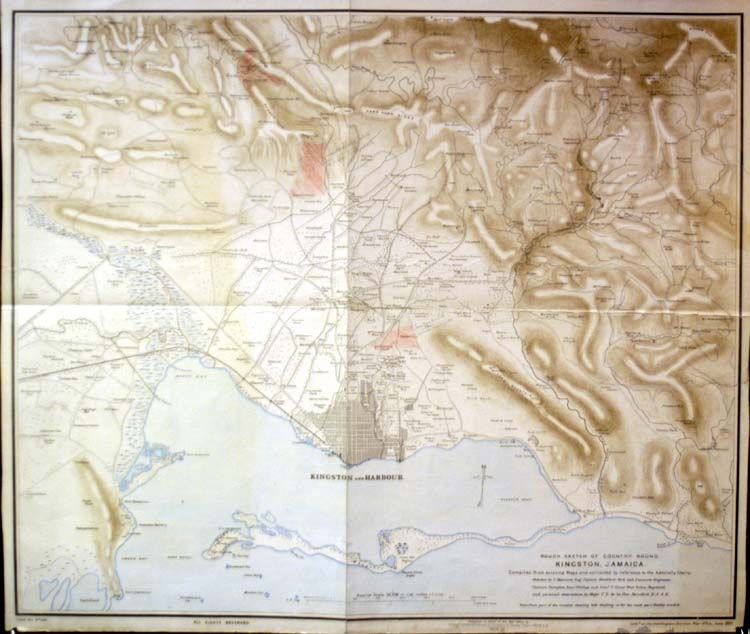
English: An extract, showing Kingston Harbour, taken from a lithographed map of Kingston and environs published by Edward Stanford for the Intelligence Division of the War Office, UK in June 1891. It was based on earlier maps and Admiralty charts, updated with the observations by five army officers. |
| Date | |
| Source | http://www.jpmaps.co.uk/mapimages/originals/31261.jpg |
| Author | Unknown author |
Licensing
|
This work is in the public domain in its country of origin and other countries and areas where the copyright term is the author's life plus 70 years or fewer. | |
| This file has been identified as being free of known restrictions under copyright law, including all related and neighboring rights. | |
File history
Click on a date/time to view the file as it appeared at that time.
| Date/Time | Thumbnail | Dimensions | User | Comment | |
|---|---|---|---|---|---|
| current | 16:10, 7 October 2009 | | 1,334 × 592 (1.05 MB) | Arb | {{Information |Description={{en|1=An extract, showing Kingston Harbour, taken from a lithographed map of Kingston and environs published by Edward Stanford for the Intelligence Division of the War Office, UK in June 1891. It was based on earlier maps and |
File usage
The following pages on the English Wikipedia use this file (pages on other projects are not listed):
Global file usage
The following other wikis use this file:
- Usage on az.wikipedia.org
- Usage on ru.wikipedia.org
.png)