
File:Kolkata Municipal Corporation ward level map as of 2011 Census.png
Size of this preview: 615 × 599 pixels. Other resolutions: 246 × 240 pixels | 493 × 480 pixels | 850 × 828 pixels.
Original file (850 × 828 pixels, file size: 223 KB, MIME type: image/png)
| This is a file from the Wikimedia Commons. Information from its description page there is shown below. Commons is a freely licensed media file repository. You can help. |
Summary
| Description |
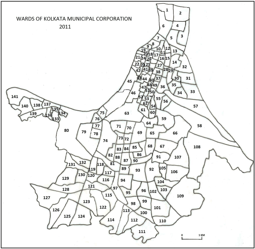
English: The jurisdiction of the Kolkata Municipal Corporation (governance at municipal/local level) is co-terminus with the jurisdiction of the Kolkata District ( governance at state, central level, census enumeration). The image is from the District Census Handbook for Kolkata from the Census of India 2011, WEST BENGA, SERIES-20 PART XII-B. |
| Date | |
| Source | https://censusindia.gov.in/2011census/dchb/1916_PART_B_DCHB_KOLKATA.pdf |
| Author | Directorate of Census Operations, West Bengal |
Licensing
This file is licensed under the Creative Commons Attribution 3.0 Unported license.
- You are free:
- to share – to copy, distribute and transmit the work
- to remix – to adapt the work
- Under the following conditions:
- attribution – You must give appropriate credit, provide a link to the license, and indicate if changes were made. You may do so in any reasonable manner, but not in any way that suggests the licensor endorses you or your use.
File history
Click on a date/time to view the file as it appeared at that time.
| Date/Time | Thumbnail | Dimensions | User | Comment | |
|---|---|---|---|---|---|
| current | 12:36, 19 October 2020 | | 850 × 828 (223 KB) | Intellectualyo | Uploaded a work by Directorate of Census Operations, West Bengal from https://censusindia.gov.in/2011census/dchb/1916_PART_B_DCHB_KOLKATA.pdf with UploadWizard |
File usage
The following pages on the English Wikipedia use this file (pages on other projects are not listed):