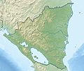
File:Nicaragua relief location map.jpg
Appearance

Size of this preview: 704 × 599 pixels. Other resolutions: 282 × 240 pixels | 564 × 480 pixels | 902 × 768 pixels | 1,203 × 1,024 pixels | 1,400 × 1,192 pixels.
Original file (1,400 × 1,192 pixels, file size: 615 KB, MIME type: image/jpeg)
File history
Click on a date/time to view the file as it appeared at that time.
| Date/Time | Thumbnail | Dimensions | User | Comment | |
|---|---|---|---|---|---|
| current | 21:05, 17 February 2010 |  | 1,400 × 1,192 (615 KB) | Alexrk2 | == Summary == {{Information |Description= {{de|Physische Positionskarte Nicaragua mit Departamentos, Quadratische Plattkarte, N-S-Streckung 100 %. Geographische Begrenzung der Karte:}} {{en|Physical Location map [[:en:Nicaragua|Nicaragua |
File usage
The following 54 pages use this file:
- Bosawás Biosphere Reserve
- Brito Formation
- Camoapa
- Cerro Negro
- Concepción (volcano)
- Cosigüina
- El Salto Formation, Nicaragua
- Escondido River (Nicaragua)
- Flor de Caña Open
- Kukra River
- Lake Apanás
- Lake Managua
- Lake Nicaragua
- Las Lajas (volcano)
- Las Pilas
- Las Sierras Formation
- León Viejo
- List of fossiliferous stratigraphic units in Central America
- Los Guatuzos Wildlife Refuge
- Maderas
- Mancotal Dam
- Mogotón
- Mombacho
- Momotombo
- Punta Gorda River
- Rota (volcano)
- Río Grande de Matagalpa
- San Cristóbal Volcano
- San Juan River (Nicaragua)
- Telica (volcano)
- Tumarín Dam
- Virgen Dam
- Water resources management in Nicaragua
- Zapatera
- Zapatera (archaeological site)
- User:Ty654/List of earthquakes from 1900-1949 exceeding magnitude 7+
- User:Ty654/List of earthquakes from 1920-1929 exceeding magnitude 6+
- User:Ty654/List of earthquakes from 1930-1939 exceeding magnitude 6+
- User:Ty654/List of earthquakes from 1950-1954 exceeding magnitude 6+
- User:Ty654/List of earthquakes from 1950-1999 exceeding magnitude 7+
- User:Ty654/List of earthquakes from 1955-1959 exceeding magnitude 6+
- User:Ty654/List of earthquakes from 1960-1964 exceeding magnitude 6+
- User:Ty654/List of earthquakes from 1970-1974 exceeding magnitude 6+
- User:Ty654/List of earthquakes from 1980-1984 exceeding magnitude 6+
- User:Ty654/List of earthquakes from 1985-1989 exceeding magnitude 6+
- User:Ty654/List of earthquakes from 1990-1994 exceeding magnitude 6+
- User:Ty654/List of earthquakes from 1995-1999 exceeding magnitude 6+
- User:Ty654/List of earthquakes from 2000-2004 exceeding magnitude 6+
- User:Ty654/List of earthquakes from 2000-present exceeding magnitude 7+
- User:Ty654/List of earthquakes from 2005-2009 exceeding magnitude 6+
- User:Ty654/List of earthquakes from 2010-2014 exceeding magnitude 6+
- User:Ty654/List of earthquakes from 2015-2019 exceeding magnitude 6+
- Module:Location map/data/Nicaragua
- Module:Location map/data/Nicaragua/doc
Global file usage
The following other wikis use this file:
- Usage on ar.wikipedia.org
- Usage on ast.wikipedia.org
- Usage on ba.wikipedia.org
- Usage on be-tarask.wikipedia.org
- Usage on be.wikipedia.org
- Usage on bg.wikipedia.org
- Usage on bh.wikipedia.org
- Usage on bn.wikipedia.org
- Usage on bs.wikipedia.org
- Usage on ca.wikipedia.org
- Usage on ceb.wikipedia.org
- Usage on ce.wikipedia.org
- Usage on ckb.wikipedia.org
- Usage on cs.wikipedia.org
- Usage on da.wikipedia.org
- Usage on de.wikipedia.org
View more global usage of this file.


