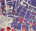
File:Noble Street and surrounding area Bombing, mapped in 1945.png
Appearance

Size of this preview: 703 × 600 pixels. Other resolutions: 281 × 240 pixels | 563 × 480 pixels | 900 × 768 pixels | 1,200 × 1,024 pixels | 2,038 × 1,739 pixels.
Original file (2,038 × 1,739 pixels, file size: 7.09 MB, MIME type: image/png)
File history
Click on a date/time to view the file as it appeared at that time.
| Date/Time | Thumbnail | Dimensions | User | Comment | |
|---|---|---|---|---|---|
| current | 10:01, 4 March 2021 |  | 2,038 × 1,739 (7.09 MB) | Jamzze | Uploaded a work by Layers of London (2021) supported by The National Lottery Heritage Fund from https://www.layersoflondon.org/ with UploadWizard |
File usage
The following page uses this file:
