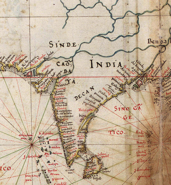
File:Portugues map of India, 1630.jpg
Appearance

Size of this preview: 554 × 599 pixels. Other resolutions: 222 × 240 pixels | 444 × 480 pixels | 710 × 768 pixels | 947 × 1,024 pixels | 1,893 × 2,047 pixels.
Original file (1,893 × 2,047 pixels, file size: 488 KB, MIME type: image/jpeg)
File history
Click on a date/time to view the file as it appeared at that time.
| Date/Time | Thumbnail | Dimensions | User | Comment | |
|---|---|---|---|---|---|
| current | 08:17, 24 June 2010 |  | 1,893 × 2,047 (488 KB) | Walrasiad | {{Information |Description={{en|1=Detail of India, from a 1630 Portuguese map of Asia, entitled Taboas geraes de toda a navegação, divididas e emendadas por Dom Ieronimo de Attayde com todos os portos principaes das conquistas de Portugal delineadas por |
File usage
The following page uses this file:
Global file usage
The following other wikis use this file:
- Usage on de.wikipedia.org
- Usage on it.wikipedia.org
- Usage on oc.wikipedia.org
- Usage on sq.wikipedia.org
