Mountains of Sis
| Mountains of Sis | |
|---|---|
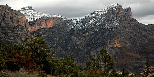
 The Mountains of Sis seen from the south | |
| Highest point | |
| Elevation | 1,791 m (5,876 ft) |
| Listing | List of mountains in Aragon |
| Coordinates | 42°24′41″N 00°38′39″E / 42.41139°N 0.64417°E |
| Geography | |
| Location | Ribagorza (Aragon) |
| Parent range | Pre-Pyrenees |
| Geology | |
| Mountain type | Conglomerate |
| Climbing | |
| Easiest route | Drive from Beranui, Sopeira or Arén |
The Mountains of Sis (Catalan: Serra de Sis, or Serra del Cis; Spanish: Sierra de Sis) is a 28 km (17 mi) long mountain range of the Pre-Pyrenees. They are located between the valleys of rivers Isábena and the Escales Reservoir, Noguera Ribagorzana, in the Ribagorza comarca, Aragon, Spain.[1] The ridge's highest summits are Pico de l'Amorriador (1791 m) and Puialto (1782 m). Other important summits are 1765 m high La Creu de Bonansa, 1490 m high Altaió d'Aulet and 1066 m high Tossal de Cornudella.
Geography
[edit]This mountain chain rises abruptly from a plain and looks quite impressive from certain angles, therefore in ancient geographic works this range was also referred to as "the Great Mountains of Sis" (Spanish: la gran sierra de Sis) owing to the massive appearance of its mountains, abruptly rising as mighty foothills of the Pyrenees.[2]
The summits of this mountain chain offer an excellent lookout point to have a view of some of the main peaks of the Pyrenees from the south, as well as of the magnificent El Turbón in the west.[3] Some of the steep rocky cliffs of the range are popular with rock climbers.[4]
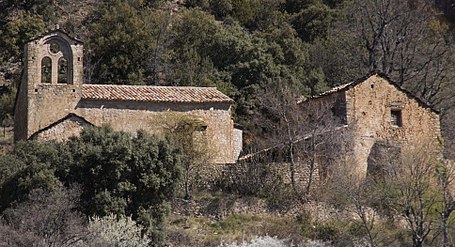
The 9th - 11th century Santa María de Obarra monastery is located at the foot of the western end of the Sierra de Sis range.[5] There are also abandoned villages and church buildings, as well as many ancient cattle farmers' buildings known as borda in the area.
|
See also
[edit]References
[edit]- ^ Gran Enciclopedia Aragonesa - Sierra de Alcubierre
- ^ Diccionario Geográfico Universal dedicado a la Reina Nuestra Señora, Sociedad de Literatos, Madrid 1792
- ^ Sierra de Sis. Pico de l´Amorriador 1791 mts
- ^ Sierra de Sis - Ribagorza[permanent dead link]
- ^ Monasterio de Santa María de Obarra (in Spanish)
External links
[edit]- El Turbón y Sierra de Sis
- Areny de Noguera
- Mills in Alto Aragon
- Beranui - Ermita de Sis
- Románico Aragonés
- Pirineos Vol 1 - Escales
Peña Montañesa


