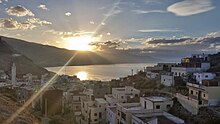
Tétouan Province
Appearance
(Redirected from Tetouan Province)

Tétouan (Arabic: تطوان) is a province in the Moroccan region of Tanger-Tétouan-Al Hoceïma. Its population in 2004 was 613,506 [1]
The major cities and towns are: [2]
Subdivisions
[edit]The province is divided administratively into the following:[1]
| Name | Geographic code | Type | Households | Population (2004) | Foreign population | Moroccan population | Notes |
|---|---|---|---|---|---|---|---|
| Oued Laou | 571.01.07. | Municipality | 1722 | 8383 | 5 | 8378 | |
| Tétouan | 571.01.11. | Municipality | 68821 | 320539 | 432 | 320107 | |
| Ain Lahsan | 571.03.01. | Rural commune | 1304 | 6552 | 0 | 6552 | |
| Bni Harchen | 571.03.07. | Rural commune | 1462 | 7646 | 0 | 7646 | |
| Jbel Lahbib | 571.03.09. | Rural commune | 818 | 4204 | 0 | 4204 | 1100 residents live in the center, called Karia; 3104 residents live in rural areas. |
| Mallalienne | 571.03.15. | Rural commune | 1965 | 9970 | 1 | 9969 | |
| Saddina | 571.03.17. | Rural commune | 1265 | 6683 | 1 | 6682 | |
| Souk Kdim | 571.03.19. | Rural commune | 1378 | 7434 | 0 | 7434 | |
| Al Hamra | 571.05.01. | Rural commune | 1610 | 10156 | 0 | 10156 | |
| Al Khrroub | 571.05.03. | Rural commune | 570 | 3018 | 0 | 3018 | |
| Al Oued | 571.05.05. | Rural commune | 1719 | 11135 | 0 | 11135 | |
| Azla | 571.05.07. | Rural commune | 2364 | 12611 | 4 | 12607 | |
| Bghaghza | 571.05.09. | Rural commune | 1158 | 6457 | 0 | 6457 | |
| Bni Idder | 571.05.11. | Rural commune | 772 | 4620 | 0 | 4620 | |
| Bni Leit | 571.05.13. | Rural commune | 784 | 5364 | 0 | 5364 | |
| Bni Said | 571.05.15. | Rural commune | 1422 | 8219 | 0 | 8219 | |
| Dar Bni Karrich | 571.05.17. | Rural commune | 1351 | 6689 | 8 | 6681 | 4780 residents live in the center, called Dar Bni Karrich; 1909 residents live in rural areas. |
| Oulad Ali Mansour | 571.05.19. | Rural commune | 828 | 5612 | 0 | 5612 | |
| Sahtryine | 571.05.21. | Rural commune | 1268 | 7402 | 0 | 7402 | |
| Zaitoune | 571.05.23. | Rural commune | 1595 | 8486 | 0 | 8486 | |
| Zaouiat Sidi Kacem | 571.05.25. | Rural commune | 1639 | 10495 | 0 | 10495 | |
| Zinat | 571.05.27. | Rural commune | 1120 | 6539 | 0 | 6539 |
References
[edit]- ^ "Recensement général de la population et de l'habitat de 2004" (PDF). Haut-commissariat au Plan, Lavieeco.com. Retrieved 27 April 2012.
35°34′00″N 5°22′00″W / 35.5667°N 5.3667°W
