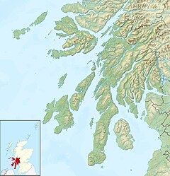
Whistlefield, Argyll
Appearance
(Redirected from Whistlefield, Argyll and Bute)
| Whistlefield | |
|---|---|
Location within Argyll and Bute | |
| OS grid reference | NS 14426 93276 |
| • Edinburgh | 70 mi (110 km) |
| Council area |
|
| Lieutenancy area |
|
| Country | Scotland |
| Sovereign state | United Kingdom |
| Post town | DUNOON |
| Postcode district | PA23 |
| Dialling code | 01369 |
| UK Parliament |
|
| Scottish Parliament |
|
Whistlefield is a hamlet on the east shore of Loch Eck on the Cowal Peninsula, in Argyll and Bute, West of Scotland.[1] It is home to the Category C listed building, the Whistlefield Inn, which was established around 1801–1804.[2][3] The hamlet is within the Argyll Forest Park,[4] which is itself part of the Loch Lomond and The Trossachs National Park.[5]
References
[edit]- ^ Ordnance Gazetteer of Scotland A Graphic and Accurate Description of Every Place in Scotland (1901) - p. 1611
- ^ "The Whistlefield Inn, Dunoon | Homepage". www.thewhistlefieldinn.com. Retrieved 2 March 2020.
- ^ "WHISTLEFIELD INN INCLUDING ANCILLARY BUILDINGS AND BOUNDARY WALLS (LB5060)". portal.historicenvironment.scot. Retrieved 2 March 2020.
- ^ "Argyll Forest Park - Forestry Commission Scotland". Scotland.forestry.gov.uk. Retrieved 17 January 2017.
- ^ "Map of Loch Lomond and the Trossachs National Park" (PDF). Loch Lomond & The Trossachs National Park Authority. Retrieved 30 July 2020.
External links
[edit]- Map sources for Whistlefield, Argyll
Wikimedia Commons has media related to Whistlefield, Argyll.

