Massey Island
Appearance
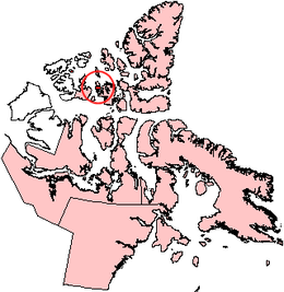
 Location of Île Vanier near Massey Island | |
| Geography | |
|---|---|
| Location | Arctic Ocean |
| Coordinates | 75°59′N 102°58′W / 75.983°N 102.967°W |
| Archipelago | Arctic Archipelago |
| Area | 432 km2 (167 sq mi) |
| Length | 47 km (29.2 mi) |
| Width | 34 km (21.1 mi) |
| Administration | |
Canada | |
| Territory | Nunavut |
| Region | Qikiqtaaluk |
| Demographics | |
| Population | Uninhabited |
Massey Island is an uninhabited island in the Bathurst Island group, Qikiqtaaluk Region, Nunavut, Canada. It is located in the Arctic Ocean, south of Île Vanier (across Pearse Strait) and north of Alexander Island and Île Marc (across Boyer Strait). It has an area of 432 km2 (167 sq mi), 47 kilometres (29 mi) long and 34 kilometres (21 mi) wide.
The island is named for former Governor General of Canada Vincent Massey.
References
[edit]External links
[edit]- Massey Island in the Atlas of Canada - Toporama; Natural Resources Canada


