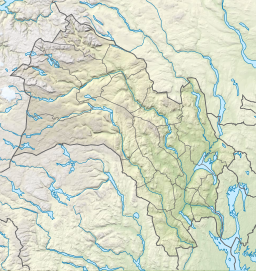
Øyangen (Ringerike)
Appearance
From Wikipedia, the free encyclopedia
Lake in Ringerike, Norway
| Øyangen | |
|---|---|
 Øyangen in winter | |
| Location | Ringerike (Buskerud) |
| Coordinates | 60°10′10″N 10°26′7″E / 60.16944°N 10.43528°E / 60.16944; 10.43528 |
| Basin countries | Norway |
| Surface area | 3.14 km2 (1.21 sq mi) |
| Shore length1 | 19.72 km (12.25 mi) |
| Surface elevation | 562 m (1,844 ft) |
| References | NVE |
| 1 Shore length is not a well-defined measure. | |
Øyangen is a lake in the municipality of Ringerike in Buskerud county, Norway. The lake is located in Nordmarka, a large wooded area north of Oslo. Fishing is popular with the lake offering perch, trout and char. [1]
See also
[edit]References
[edit]Hidden categories:
- Pages using gadget WikiMiniAtlas
- Articles with short description
- Short description matches Wikidata
- Coordinates on Wikidata
- Articles using infobox body of water without alt
- Articles using infobox body of water without pushpin map alt
- Articles using infobox body of water without image bathymetry
- All stub articles

