Anderlecht Municipal Hall
Appearance
| Anderlecht Municipal Hall | |
|---|---|
 Anderlecht's Municipal Hall | |
| General information | |
| Type | Municipal hall |
| Location | Place du Conseil / Raadsplein 1 |
| Town or city | 1070 Anderlecht, Brussels-Capital Region |
| Country | Belgium |
| Coordinates | 50°50′21″N 4°19′44″E / 50.83917°N 4.32889°E |
| Design and construction | |
| Architect(s) | Jules Jacques Van Ysendyck |
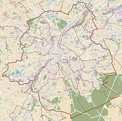
The Municipal Hall (French: Hôtel communal; Dutch: Gemeentehuis) of Anderlecht is the municipal hall building and the seat of that municipality of Brussels, Belgium. Designed by the architect Jules Jacques Van Ysendyck in neo-Flemish Renaissance style and completed in 1879, it is located at 1, place du Conseil/Raadsplein in Cureghem/Kuregem.[1] This site is served by Clemenceau metro station on lines 2 and 6 of the Brussels Metro, as well as the tram stop Conseil/Raad (on line 81).[2]
See also
[edit]- Brussels Town Hall
- Forest Municipal Hall
- Molenbeek-Saint-Jean Municipal Hall
- Saint-Gilles Municipal Hall
- Schaerbeek Municipal Hall
References
[edit]Citations
[edit]- ^ "Hôtel communal d'Anderlecht – Inventaire du patrimoine architectural". monument.heritage.brussels (in French). Retrieved 16 February 2023.
- ^ "Ligne 81 vers MARIUS RENARD - stib.be". www.stib-mivb.be. Retrieved 16 February 2023.
Bibliography
[edit]- Jean Van Audenhove, Anderlechtenia, Les Rues d'Anderlecht (in French), CAFHA (1995), p. 80–81.
- Jean-Marie Delaunois, Benoît Schoonbroodt, Guide des communes de la Région Bruxelloise (in French), CFC-Editions (1998), p. 75–78.
- Marcel Jacobs, Anderlecht, gisteren en vandaag, au passé et au présent (in Dutch–French), Het Streekboek (1999), pp. 82.
External links
[edit] Media related to Town hall of Anderlecht at Wikimedia Commons


