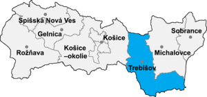
Bara, Trebišov District
Appearance

Bara (Hungarian: Bári) is a village and municipality in the Trebišov District in the Košice Region of eastern Slovakia.
History
[edit]The village was first mentioned as Bary in historical records from 1296. Until 1920, it was part of Hungary. From 1938 until 1944, it was occupied by Hungary under the First Vienna Award.
Geography
[edit]The village lies at an altitude of 181 metres and covers an area of 6.252 km2 (2.414 sq mi). It has a population of 350 people.
Ethnicity
[edit]The village is approximately 72% Hungarian and 28% Slovak.
Genealogical resources
[edit]The records for genealogical research are available at the state archive in Košice (Slovak: Štátny archív v Košiciach).
- Greek Catholic church records (births/marriages/deaths): 1770-1895 (parish B)
- Reformated church records (births/marriages/deaths): 1782-1945 (parish A)
See also
[edit]External links
[edit]48°26′N 21°43′E / 48.433°N 21.717°E
