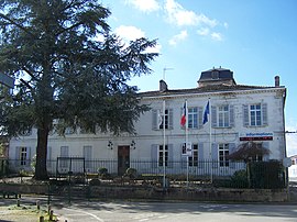
Barsac, Gironde
This article needs additional citations for verification. (October 2021) |
Barsac | |
|---|---|
 Town hall | |
| Coordinates: 44°36′37″N 0°18′47″W / 44.6103°N 0.3131°W | |
| Country | France |
| Region | Nouvelle-Aquitaine |
| Department | Gironde |
| Arrondissement | Langon |
| Canton | Les Landes des Graves |
| Government | |
| • Mayor (2020–2026) | Dominique Cavaillols[1] |
Area 1 | 14.48 km2 (5.59 sq mi) |
| Population (2021)[2] | 2,065 |
| • Density | 140/km2 (370/sq mi) |
| Time zone | UTC+01:00 (CET) |
| • Summer (DST) | UTC+02:00 (CEST) |
| INSEE/Postal code | 33030 /33720 |
| Elevation | 3–21 m (9.8–68.9 ft) (avg. 8 m or 26 ft) |
| 1 French Land Register data, which excludes lakes, ponds, glaciers > 1 km2 (0.386 sq mi or 247 acres) and river estuaries. | |
Barsac (French pronunciation: [baʁsak]; Gascon: Barçac) is a commune on the left bank of the Garonne river in the Gironde department in southwestern France.
Geography
[edit]Barsac is located 37 km upstream the Garonne river of Bordeaux. Barsac station has rail connections to Langon and Bordeaux.
Population
[edit]| Year | Pop. | ±% p.a. |
|---|---|---|
| 1968 | 2,298 | — |
| 1975 | 2,019 | −1.83% |
| 1982 | 2,085 | +0.46% |
| 1990 | 2,058 | −0.16% |
| 1999 | 1,948 | −0.61% |
| 2007 | 1,962 | +0.09% |
| 2012 | 2,106 | +1.43% |
| 2017 | 2,063 | −0.41% |
| Source: INSEE[3] | ||
Wine
[edit]The town gives its name to a wine making appellation, Barsac AOC, that produces sweet white wines.
The town and its vineyards are separated from the area of Sauternes to the south by the Ciron river, whose cooling effect is of key importance in encouraging the annual action of the Botrytis fungus on the Sémillon grapes. The area is marginally flatter than its neighbour and its wines are considered to be marginally lighter. The area is however permitted to use the Sauternes appellation.
Producers from the area include the First Growths Château Climens, and Château Coutet.
Personalities
[edit]- Venerable Marie-Thérèse de Lamourous (1754 – 1836), a French Lay-woman, member of the underground Church during the French Revolution, and foundress of the Sister of the Miséricorde of Bordeaux.
See also
[edit]References
[edit]- ^ "Répertoire national des élus: les maires". data.gouv.fr, Plateforme ouverte des données publiques françaises (in French). 9 August 2021.
- ^ "Populations légales 2021" (in French). The National Institute of Statistics and Economic Studies. 28 December 2023.
- ^ Population en historique depuis 1968, INSEE
External links
[edit]


