Beinn na Lap
Appearance
| Beinn na Lap | |
|---|---|
 Beinn na Lap as seen from Rannoch Moor | |
| Highest point | |
| Elevation | 935 m (3,068 ft)[1] |
| Prominence | 406 m (1,332 ft) |
| Listing | Munro, Marilyn |
| Coordinates | 56°47′22″N 4°39′36″W / 56.7894°N 4.6599°W |
| Geography | |
 | |
| Location | Highland, Scotland |
| Parent range | Grampian Mountains |
| OS grid | NN376695 |
| Topo map | OS Landranger 41 |
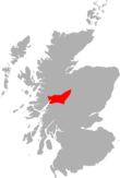
Beinn na Lap (935 m) is a mountain in the Grampian Mountains of Scotland. It lies at the northern end of Rannoch Moor, near to Corrour railway station.
A rounded mountain, the ascent from Corrour Station is quite straightforward and short, making it one of the easier Munros to climb.[2]
References
[edit]- ^ "Beinn na lap". hill-bagging.co.uk. Retrieved 14 May 2019.
- ^ "walkhighlands Beinn a'Chlachair". walkhighlands.co.uk. Retrieved 14 May 2019.


