Bradwell Abbey
| Bradwell Abbey | |
|---|---|
 Chapel at Bradwell Abbey | |
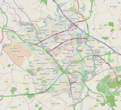
Mapping © OpenStreetMap Location within Buckinghamshire | |
| OS grid reference | SP826395 |
| Civil parish | |
| Unitary authority | |
| Ceremonial county | |
| Region | |
| Country | England |
| Sovereign state | United Kingdom |
| Post town | MILTON KEYNES |
| Postcode district | MK13 |
| Dialling code | 01908 |
| Police | Thames Valley |
| Fire | Buckinghamshire |
| Ambulance | South Central |
| UK Parliament | |
Bradwell Abbey or Bradwell Priory is a scheduled monument, urban studies site, district and former civil parish in Milton Keynes, Buckinghamshire, England. The site was once the location of a Benedictine priory, founded in 1155.
Historic Bradwell Priory
[edit]The Priory was established around 1154.[1] It grew during the Middle Ages to become an important local centre, but declined during the Black Death when, amongst others, its prior William of Loughton died.[1] The Priory was closed in 1524 (some 12 years before the general dissolution of the monasteries) and the site of the monastery and its scanty revenues were granted to Cardinal Wolsey for the endowment of his new college.[2] All that remains today is a small chapel and a farmhouse that has become a centre for cultural activities and an Urban Studies centre. Many of the medieval trackways converging on the abbey became rights of way and bridleways and subsequently became part of the Milton Keynes redway system (a network of shared paths).
The arrival of the West Coast Main Line railway split the Abbey lands, with Bradwell village to the east of the line and the Abbey to the west. Today, the small Bradwell Abbey district includes parkland and industry outside the Abbey grounds.
The Abbey site in total is a Scheduled Monument.[3] The Chapel of St Mary is a Grade I listed building.[4] There are a further five Grade II listed buildings or structures on the Abbey grounds.[5]
Bradwell Abbey today
[edit]Today, Bradwell Abbey is home to the Milton Keynes City Discovery Centre (an urban studies centre),[6] providing a workspace, library and guidance for visiting international town planners and students who wish to study the development of Milton Keynes. It also hosts school visits to see its medieval buildings – the chapel is Grade I listed[7] – its fish ponds and its physic garden, and how they have changed since then. Finally the Abbey provides meeting space to local community groups.
Togfest
[edit]An annual music festival was started on the site in 1999. Performers have included Vikki Clayton in 1999, Joe Driscoll in 2005. In 2009 the festival dates were 26 and 27 June and acts performing included The Swanvesta Social Club.
Bradwell Abbey district
[edit]The modern Bradwell Abbey district is a relatively small one, sandwiched as it is between the West Coast Main Line to the east, the A5 to the west, H3 Monks Way (A422) to the north and H4 Dansteed Way to the south. It includes a small industrial estate and the Loughton Valley flood plain "linear park". The Swan's Way long-distance path and the Sustrans route 51 follow the valley.
Formally, it is in the Bradwell grid-square, but this square is split into three parts by the railway line (on an embankment) and the A5 (in a cutting).
Civil parish
[edit]From 1858 to 2011, "Bradwell Abbey" was also the name of a civil parish stretching from a little west of Watling Street to a little east of the West Coast Main Line (and thus on either side of the (modern) A5).[8] In 1971 the parish had a population of 11.[9]
On 1 April 2011, the parish was abolished and divided: the part west of the A5 became Abbey Hill CP; the part east of the A5 and north of the A422 (a tiny part of Stacey Bushes and Bancroft) became part of Wolverton and Greenleys CP; and the remainder, the Abbey site and the adjacent lands east of the A5 and south of the A422, became part of Bradwell CP.[10]
See also
[edit]References
[edit]- ^ a b Markham, Sir Frank (1986) [1973]. History of Milton Keynes and District. White Crescent Press. pp. 105–108. ISBN 0-900804-29-7.
- ^ 'Houses of Benedictine monks: The priory of Bradwell' – Victoria History of the Counties of England, A History of the County of Buckingham: Volume 1 (1905), pp. 350–352. Date accessed: 22 September 2009.
- ^ Historic England (16 June 1948). "Bradwell Abbey: a Benedictine priory, chapel and fishpond (1009540)". National Heritage List for England. Retrieved 28 February 2022.
- ^ Historic England (3 March 1952). "CHAPEL TO NORTH OF BRADWELL ABBEY HOUSE (1125271)". National Heritage List for England. Retrieved 28 February 2022.
- ^ "Search Results for 'Bradwell Abbey'". Historic England. Retrieved 28 February 2022.
- ^ Milton Keynes City Discovery Centre
- ^ Historic England. "Details from listed building database (1125271)". National Heritage List for England. Retrieved 6 January 2009.
- ^ "Boundary Map of Bradwell Abbey CP/ExP". A Vision of Britain through Time. Retrieved 15 May 2024.
- ^ "Population statistics Bradwell Abbey CP/ExP through time". A Vision of Britain through Time. Retrieved 15 May 2024.
- ^ "Milton Keynes Registration District". UKBMD. Retrieved 15 May 2024.
External links
[edit]- "The architectural secrets of Milton Keynes" – BBC (with audio content)
- Places to go: Bradwell Abbey and City Discovery Centre
- The history of Bradwell Abbey – City Discovery Centre. Includes video tour.
- Milton Keynes City Discovery Centre (Urban Studies educational centre).
- Togfest Music Festival
- William Page, ed. (1927). "Parishes : Bradwell". A History of the County of Buckingham. Victoria History of the Counties of England. Vol. 4. London: Constable & Co. Ltd. pp. 283–288.


