Charbatia Air Base
Charbatia Air Base ARC Field | |||||||||||
|---|---|---|---|---|---|---|---|---|---|---|---|
| Summary | |||||||||||
| Operator | Aviation Research Centre | ||||||||||
| Location | Cuttack, Odisha, India | ||||||||||
| Elevation AMSL | 115 ft / 35 m | ||||||||||
| Coordinates | 20°32′58.63″N 085°53′10.54″E / 20.5496194°N 85.8862611°E[1] | ||||||||||
| Map | |||||||||||
 | |||||||||||
| Runways | |||||||||||
| |||||||||||
Source: DAFIF | |||||||||||
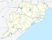
Charbatia Air Base (ICAO: VE62) is located approximately 12 km north of Cuttack, Odisha in eastern India. It is an aerial reconnaissance post of the intelligence agency's aviation unit, the Aviation Research Centre (ARC).[2] The Research and Analysis Wing, India's primary foreign intelligence agency, operates intelligence collection aircraft through the ARC. The aircraft are fitted with electronic surveillance equipment and long range cameras capable of taking pictures of targets from high altitudes.
The airstrip was built by the British during World War II[3] and was abandoned after the war.[citation needed] During the Sino-Indian War, prime minister Jawaharlal Nehru agreed to allow the Central Intelligence Agency to fly U2 reconnaissance missions over India in order to surveil the India-China border.[4][5] The following year, Charbatia Air Base was further renovated and was used by the CIA, which conducted multiple U2 surveillance missions from the base between 1964 and 1967.[4][5]
The first aircraft was delivered in the mid 60s and was a World War II vintage C-46 which was outfitted with an oxygen distribution system for operator and flight personnel along with surveillance electronics and recording equipment at the Air America base in Tainan, Taiwan.[citation needed] The installation was supervised by the design engineer, Mr. Kent Williamson. Mr. Williamson, along with other experienced personnel also deployed to Charbatia to train the first operator and maintenance personnel. Later additions to the surveillance equipment include specially outfitted Boeing 727 and Gulfstream III jets.[citation needed]
The air base is spread over 2,000 acres (8.1 km2). In 2011, the Government of India which controls the airbase announced that it will be converted into a full-fledged Indian Air Force station with six C-130J Super Hercules transport aircraft.[6][7][dead link][8][dead link] But the plans for setting up such a station was subsequently cancelled and the C-130 Hercules transport unit was shifted to Panagarh air force base in West Bengal.[9]
References
[edit]- ^ "Cuttack". World Aero Data. Archived from the original on 29 July 2018. Retrieved 3 October 2011.
{{cite web}}: CS1 maint: unfit URL (link) - ^ "AAI Unserved Airports" (PDF). aai.aero. Airports Authority of India.
- ^ "Planes, war, spying..." thehindu.com. The Hindu. 2 June 2016.
- ^ a b "Nehru permitted CIA spy planes to use Indian air base". indianexpress.com. Indian Express. 16 August 2013.
- ^ a b "Nehru allowed overflights of US spy planes: Report". Business Standard. 16 August 2013.
- ^ "Upgrading air bases to counter attacks: IAF chief". Deccan Herald. 10 October 2011. Retrieved 16 February 2012.
- ^ Mohanty, Subhashish (1 November 2010). "Air chief wants base in Cuttack". The Telegraph. Calcutta, India. Retrieved 3 October 2011.
- ^ "Odisha CM says IAF likely to set up operational base at Charbatia". 4 May 2011. Archived from the original on 29 July 2018. Retrieved 3 October 2011.
- ^ Chanda, Arup (31 January 2016). "IAF Boosts Bengal to Tame Dragon". The New Indian Express. Retrieved 28 July 2018.


