Cheriton, Hampshire
| Cheriton | |
|---|---|
 View of the village centre and Itchen | |
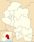
Location within Hampshire | |
| Population | 1,000 [1][2] |
| OS grid reference | SU582284 |
| Civil parish |
|
| District | |
| Shire county | |
| Region | |
| Country | England |
| Sovereign state | United Kingdom |
| Post town | ALRESFORD |
| Postcode district | SO24 |
| Dialling code | 01962 |
| Police | Hampshire and Isle of Wight |
| Fire | Hampshire and Isle of Wight |
| Ambulance | South Central |
| UK Parliament | |

Cheriton is a village and civil parish near Alresford in Hampshire, England.
The settlement is close to the site of the 1644 Battle of Cheriton, fought during the First English Civil War.
Facilities and Services
[edit]Cheriton has two pubs, and a local shop that contains a sub-post office. The Flower Pots Inn has its own microbrewery,[3] and has won numerous awards for brewing over the past twenty years as attested to by the certificates adorning its walls. The community also enjoys the village hall, tennis courts and cricket pitches which offer a quintessentially English country scene.[4]
The Church of England parish church dates from the 13th century and is dedicated to St Michael and All Angels. The chancel was extended in the 15th century and the tower, porch and aisle walls were rebuilt following a fire in 1744. It is a Grade I listed building.[5]
About 1 mile (1.6 km) to the east of the village is a monument to the Battle of Cheriton which was fought on 29 March 1644 and resulted in the defeat of the Royalist army.[6]
References
[edit]- ^ "Parish Headcounts, Area: Cheriton CP". Neighbourhood Statistics. Office for National Statistics. 2001. Archived from the original on 12 June 2011. Retrieved 6 October 2008. The population was similar in 1871 at 642 (William White (1878) History, Gazetter and Directory of the County of Hampshire).
- ^ "Civil Parish population 2011". Neighbourhood Statistics. Office for National Statistics. Retrieved 8 December 2016.
- ^ Good Beer Guide 2019. CAMRA Books. 2018. p. 562. ISBN 978-1852493547.
- ^ The Rough Guide to Dorset, Hampshire & the Isle of Wight. Rough Guides. 2017. p. 284. ISBN 978-0241253939.
- ^ Historic England. "CHURCH OF ST MICHAEL (1303010)". National Heritage List for England. Retrieved 1 May 2020.
- ^ Foard, G; Partida, T (May 2005). "Battle of Cheriton". www.battlefieldstrust.com. The Battlefields Trust. Retrieved 1 May 2020.
External links
[edit]![]() Media related to Cheriton, Hampshire at Wikimedia Commons
Media related to Cheriton, Hampshire at Wikimedia Commons


