Coalsnaughton
Appearance
| Coalsnaughton | |
|---|---|
 A wintry day in Ramsay Street/Castle Street of Coalsnaughton, February 2008 | |
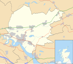
Location within Clackmannanshire | |
| Population | 1,290 (2022)[1] |
| OS grid reference | NS919956 |
| Council area | |
| Lieutenancy area | |
| Country | Scotland |
| Sovereign state | United Kingdom |
| Post town | Tillicoultry |
| Postcode district | FK13 |
| Dialling code | 01259 |
| Police | Scotland |
| Fire | Scottish |
| Ambulance | Scottish |
| UK Parliament | |
| Scottish Parliament | |
Coalsnaughton or Calabar (Scottish Gaelic: Caolas Neachdainn) is a village in Clackmannanshire, Scotland.[2][3] It is just south of Tillicoultry of which it also lies in its parish. The miners' row was built by Robert Bald.[4]
References
[edit]- ^ "Mid-2020 Population Estimates for Settlements and Localities in Scotland". National Records of Scotland. 31 March 2022. Retrieved 31 March 2022.
- ^ Ordnance Survey: Landranger map sheet 58 Perth & Alloa (Auchterarder) (Map). Ordnance Survey. 2014. ISBN 9780319229972.
- ^ "Ordnance Survey: 1:50,000 Scale Gazetteer" (csv (download)). www.ordnancesurvey.co.uk. Ordnance Survey. 1 January 2016. Retrieved 18 February 2016.
- ^ Clackmannan and the Ochils, by Adam Swan ISBN 07073 0513 6
Wikimedia Commons has media related to Coalsnaughton.

