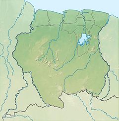
Cottica River
Appearance
| Cottica River | |
|---|---|
 On the banks of the Cottica River in 1965 | |
| Native name | Kotika-liba (Sranan Tongo) |
| Location | |
| Country | Suriname |
| District | Marowijne |
| Physical characteristics | |
| Source | |
| • location | Patamacca |
| • coordinates | 5°23′02″N 54°28′16″W / 5.3838°N 54.4711°W |
| Mouth | Commewijne River |
• coordinates | 5°52′00″N 54°52′00″W / 5.866667°N 54.866667°W |
| Basin features | |
| Progression | Commewijne River→Atlantic Ocean |
Cottica River (Sranan Tongo: Kotika-liba) is a river in the northeast of Suriname.
It originates in the hills surrounding town of Moengo and flows westwards and enters the Commewijne River at Fort Sommelsdijk.
It has a river basin of 2.900 km2.
References
[edit]- Bruijning, Conrad Friederich Albert; Jan Voorhoeve (1977). Encyclopedie van Suriname. Amsterdam: Elsevier. ISBN 90-10-01842-3.

