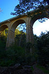
Cremorne Railway Bridge
Appearance
Cremorne Railway Bridge | |
|---|---|
 | |
| Coordinates | 37°50′01″S 144°59′35″E / 37.8336°S 144.993°E |
| Carries | Trains |
| Crosses | Yarra River |
| Locale | Melbourne, Australia |
| Location | |
 | |
The Cremorne Railway Bridge crosses the Yarra River three kilometres south-east of Melbourne connecting Richmond and South Yarra stations on the Frankston, Pakenham, Cranbourne, and Sandringham railway lines.
History
[edit]The first bridge on the site was a double-track structure, opened in December 1860 by the Melbourne and Suburban Railway Company.[1][2] In 1886, a second double-track bridge was opened alongside the first, thereby allowing a four-track section of line to be provided between Richmond and South Yarra.[3] The present bridge was opened in 1946.[4] It accommodated three pairs of tracks between Richmond and South Yarra, although the two extra tracks were not constructed until 1960.[5]
References
[edit]- ^ "MELBOURNE AND SUBURBAN RAILWAY COMPANY". The Argus (Melbourne). No. 4, 280. Victoria, Australia. 29 February 1860. p. 7. Retrieved 22 April 2017 – via National Library of Australia.
- ^ "THE CREMORNE RAILWAY BRIDGE". The Argus (Melbourne). No. 12, 474. Victoria, Australia. 18 June 1886. p. 7. Retrieved 22 April 2017 – via National Library of Australia.
- ^ "The Cremorne Railway Bridge". The Argus. Melbourne, Vic. 18 June 1886. p. 7. Retrieved 19 November 2011.
- ^ "Photo:FIRST SECTION". The Argus. Melbourne, Vic. 5 June 1946. p. 15. Retrieved 19 November 2011., ...of new Cremorne railway bridge over Yarra is now in use after 2 years' work...
- ^ "Sth Yarra". Victorian Railways . net. Mark Bau. Retrieved 19 August 2019.

