Deansboro, New York
Appearance
Deansboro, New York | |
|---|---|
 | |
| Coordinates: 42°59′42″N 75°25′43″W / 42.99500°N 75.42861°W | |
| Country | United States |
| State | New York |
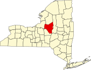
| County | Oneida |
| Elevation | 817 ft (249 m) |
| Time zone | UTC-5 (Eastern (EST)) |
| • Summer (DST) | UTC-4 (EDT) |
| ZIP code | 13328[1] |
| Area code | 315 |
| GNIS feature ID | 948145[2] |
Deansboro is a hamlet in Oneida County, New York, United States.[2]
The Deansboro Railroad Station was listed on the National Register of Historic Places in 2002.[3]
References
[edit]- ^ "Deansboro ZIP Code". zipdatamaps.com. 2022. Retrieved November 11, 2022.
- ^ a b "Deansboro". Geographic Names Information System. United States Geological Survey, United States Department of the Interior.
- ^ "National Register Information System". National Register of Historic Places. National Park Service. March 13, 2009.


