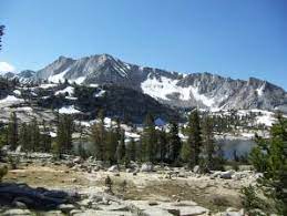
Disappointment Lake (California)
Appearance
| Disappointment Lake | |
|---|---|
 | |
| Location | The Sierra Nevada Mountains, within Fresno County, California. |
| Coordinates | 37°08′24″N 118°49′04″W / 37.13988°N 118.81777°W |
| Type | Alpine lake |
| Part of | Red Mountain Basin[1] |
| Primary outflows | Fleming Creek[2] |
| Basin countries | United States |
| Max. length | 1,247 ft (380 m)[3] |
| Max. width | 818 ft (249 m)[3] |
| Surface area | 7.59 hectares (18.8 acres) [4] |
| Shore length1 | 1.11 km (0.69 mi)[5] |
| Surface elevation | 3,153 metres (10,344 ft)[5] |
| 1 Shore length is not a well-defined measure. | |
Disappointment Lake is an Alpine lake located in the John Muir Wilderness, which is part of the Sierra Nevada mountain range. The lake is found by following the Hell for Sure Trail which continues up to Hell for Sure Lake and Hell for Sure Pass. Mount Hutton can be found approximately 1.35 mi (2.17 km) to the south east and Red Mountain can be found approximately 1.13 mi (1.82 km) to the northeast.[1]
Nearby Lakes
[edit]Disappointment Lake is part of the Red Mountain basin of which there are a few lakes including Hell for Sure Lake, Horseshoe Lake, and Devil's Punchbowl.[6]
See also
[edit]References
[edit]- ^ a b United States Geological Survey (2021). Mount Henry, CA (JPEG) (Topographic map). 1:24,000. 7.5 Minute Series. United States Geological Survey. Retrieved June 13, 2022.
- ^ United States Geological Survey (1912). Mt.Goddard Quadrangle (JPEG) (Topographic map). 1:24,000. 7.5 Minute Series. United States Geological Survey. Retrieved June 14, 2022.
- ^ a b "Disappointment Lake" (Map). OpenStreetMap. 22 October 2017. Retrieved 14 June 2022.
- ^ "National Hydrography Dataset U.S. Geological Survey". www.usgs.gov. Retrieved 2022-06-13.
- ^ a b "Surface Water Ambient Monitoring Program (SWAMP)". www.waterboards.ca.gov. Retrieved 2022-06-13.
- ^ Finch, Bill (June 2001). "Lakes of the Red Mountain Basin - June 2001". www.sierrahiker.com. Retrieved 2022-06-14.


