Galuanta
Appearance
Galuanta
| |
|---|---|
Village | |
| Coordinates: 42°14′04″N 43°53′37″E / 42.23444°N 43.89361°E | |
| Country | |
| De facto state | South Ossetia[n 1] |
| Time zone | UTC+4 (Georgian Time) |
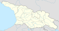
Galuanta (Georgian: გალუანთა; Ossetian: Галуантæ) is a settlement in the Gori district of Georgia.[1] Since 1991 settlement is in the Khetagurovo Community, Tskhinvali District of South Ossetia.
Geography
[edit]Located on Shida Kartli plain. 900 meters above sea level.
See also
[edit]Notes
[edit]- ^ South Ossetia's status is disputed. It considers itself to be an independent state, but this is recognised by only a few other countries. The Georgian government and most of the world's other states consider South Ossetia de jure a part of Georgia's territory.
References
[edit]- ^ Президиум Верховного Совета Грузинской Советской Социалистической Республики (1988). Грузинская ССР. Административно-территориальное деление на 1 января 1987 г. Тбилиси: Сабчота Сакартвело. p. 272.


