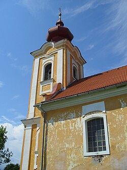
Gemerská Ves
Gemerská Ves
Gömörfalva | |
|---|---|
 | |
Location of Gemerská Ves in the Banská Bystrica Region Location of Gemerská Ves in Slovakia | |
| Coordinates: 48°29′N 20°16′E / 48.48°N 20.27°E | |
| Country | |
| Region | |
| District | Revúca District |
| First mentioned | 1266 |
| Area | |
• Total | 17.70 km2 (6.83 sq mi) |
| Elevation | 196 m (643 ft) |
| Population (2021)[3] | |
• Total | 992 |
| Time zone | UTC+1 (CET) |
| • Summer (DST) | UTC+2 (CEST) |
| Postal code | 982 62[2] |
| Area code | +421 47[2] |
| Car plate | RA |
| Website | www |
Gemerská Ves (Hungarian: Gömörfalva) is a village and municipality in Revúca District in the Banská Bystrica Region of Slovakia.
History
[edit]It arose in 1964 for the union of the Hrkáč (Hungarian: Harkács) and Šankovice (Hungarian: Sánkfalva) in a unique municipality. Hrkáč was first mentioned, in the past, in 1274 (Harkach), when King Ladislav gave the village to Otročok. In the 16th century it suffered because of Turkish devastations. Šankovice, instead, was first mentioned in 1266 (1266 Raas, 1294 Sank, 1421 Sankfalua) and derives its name from the Slavic name Šank. It belonged to families Sánkfalvay, local feudatories, and Hösoy. It was destroyed by Turks in 1556. In the 18th century, it belonged to families Steinicher and local landowners Draskóczy. From 1938 to 1945 both the villages were annexed by Hungary.
Genealogical resources
[edit]The records for genealogical research are available at the state archive "Statny Archiv in Banska Bystrica, Slovakia"
- Roman Catholic church records (births/marriages/deaths): 1733-1896 (parish B)
- Greek Catholic church records (births/marriages/deaths): 1817-1939 (parish B)
- Lutheran church records (births/marriages/deaths): 1730-1895 (parish B)
See also
[edit]References
[edit]- ^ "Hustota obyvateľstva - obce [om7014rr_ukaz: Rozloha (Štvorcový meter)]". www.statistics.sk (in Slovak). Statistical Office of the Slovak Republic. 2022-03-31. Retrieved 2022-03-31.
- ^ a b c "Základná charakteristika". www.statistics.sk (in Slovak). Statistical Office of the Slovak Republic. 2015-04-17. Retrieved 2022-03-31.
- ^ "Počet obyvateľov podľa pohlavia - obce (ročne)". www.statistics.sk (in Slovak). Statistical Office of the Slovak Republic. 2022-03-31. Retrieved 2022-03-31.
External links
[edit]- https://web.archive.org/web/20080111223415/http://www.statistics.sk/mosmis/eng/run.html
- Surnames of living people in Gemerska Ves


