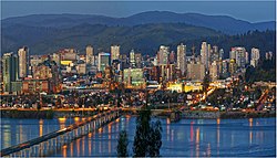
Greater Concepción
Gran Concepción | |
|---|---|
 | |
| Nickname: Pencopolis | |
 Gran Concepción (Metropolis of Concepción) | |
| Coordinates: 36°47′0″S 73°07′0″W / 36.78333°S 73.11667°W | |
| Region | Biobío |
| Province | Concepción Province |
| Foundation | October 5, 1550 |
| Elevation | 4 m (13 ft) |
| Population (2017)2 | |
| • Metro | 1,001,285 |
| Time zone | UTC-4 (Chile Time (CLT)[1]) |
| • Summer (DST) | UTC-3 (Chile Summer Time (CLST)[2]) |
| Website | concepcion.cl |

Gran Concepción is the third largest conurbation in Chile, after Greater Santiago and Greater Valparaíso, with 945,650 inhabitants according to the 2012 pre census.
Overview
[edit]It takes its name after the city of Concepción, the regional capital and main city.
The agglomeration is composed of:
Gran Concepción has also the second largest concentration of universities in Chile. Apart from the so-called Traditional Universities, it has several private institutions. The Universidad de Concepción is the most important university in the conurbation.
There is also a commuter rail system which serves most of the communes (Spanish: comunas) in the conurbation: Biotren.
Commerce
[edit]The commerce in Greater Concepcion is mostly located in Concepcion city center, also in the Mall Plaza el Trebol, in Talcahuano.
Education
[edit]Universities
[edit]- Universidad de Concepción (Concepción)
- Universidad del Bío-Bío (Concepción)
- Universidad Católica de la Santísima Concepción (Concepción)
- Universidad Técnica Federico Santa María (Hualpén)
- Universidad de Los Lagos (Concepción)
- Universidad del Desarrollo (Concepción)
- Universidad San Sebastián (Concepción)
- Universidad Andrés Bello (Talcahuano)
- Universidad Santo Tomás (Concepción)
- Universidad Tecnológica de Chile (Talcahuano)
- Universidad de las Américas (Concepción)
- Universidad La República (Concepción)
- Universidad ARCIS (Concepción)
- Universidad Bolivariana (Concepción)
- Universidad de Pedro de Valdivia (Concepción)
- Universidad del Pacífico (Concepción)
Institutes
[edit]- Instituto Profesional INACAP (Talcahuano)
- Instituto Profesional DuocUC (Concepción)
- Instituto Profesional Santo Tomás (Concepción)
- Instituto Profesional AIEP (Concepción)
- Instituto Profesional Providencia (Concepción)
- Instituto de Estudios Bancarios Guillermo Subercaseaux (Concepción)
- Instituto Profesional Virginio Gómez (Concepción)
- Instituto Profesional Diego Portales (Concepción)
- Instituto Tecnológico UCSC (Talcahuano)
- Instituto Profesional La Araucana (Concepción)
- Instituto Profesional Valle Central (Concepción)
References
[edit]- ^ "Chile Time". World Time Zones .org. Archived from the original on 2007-09-11. Retrieved 2007-05-05.
- ^ "Chile Summer Time". World Time Zones .org. Archived from the original on 2007-09-11. Retrieved 2007-05-05.
