Grovespring, Missouri
Appearance
Grovespring, Missouri | |
|---|---|
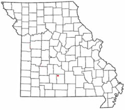
 Location of Grovespring in Missouri | |
| Country | United States |
| State | Missouri |
| County | Wright |
| Area | |
• Total | 1.19 sq mi (3.09 km2) |
| • Land | 1.19 sq mi (3.09 km2) |
| • Water | 0.00 sq mi (0.00 km2) |
| Population (2020) | |
• Total | 187 |
| • Density | 156.62/sq mi (60.46/km2) |
| FIPS code | 29-29656 |
| GNIS feature ID | 718906[2] |
Grovespring is an unincorporated community in Wright County, Missouri, United States.[2] It is located on Missouri Route 5, approximately 20 miles (32 km) south of Lebanon, Missouri in neighbouring Laclede County.
A post office called Grovespring was established in 1872, and the name was changed to Grovespring in 1895.[3]
Demographics
[edit]| Census | Pop. | Note | %± |
|---|---|---|---|
| 2020 | 187 | — | |
| U.S. Decennial Census[4] | |||
References
[edit]- ^ "ArcGIS REST Services Directory". United States Census Bureau. Retrieved September 5, 2022.
- ^ a b U.S. Geological Survey Geographic Names Information System: Grovespring, Missouri
- ^ "Post Offices". Jim Forte Postal History. Retrieved January 3, 2017.
- ^ "Census of Population and Housing". Census.gov. Retrieved June 4, 2016.
37°23′59″N 92°36′35″W / 37.39972°N 92.60972°W

