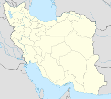
Jam Airport
Appearance
This article relies largely or entirely on a single source. (April 2024) |
Jam Airport | |||||||||||
|---|---|---|---|---|---|---|---|---|---|---|---|
| Summary | |||||||||||
| Airport type | Public | ||||||||||
| Location | Jam, Iran | ||||||||||
| Elevation AMSL | 2,172 ft / 662 m | ||||||||||
| Coordinates | 27°49.24′N 052°21.12′E / 27.82067°N 52.35200°E | ||||||||||
| Map | |||||||||||
 | |||||||||||
| Runways | |||||||||||
| |||||||||||
Sources: DoD FLIP[1] | |||||||||||
Jam Airport (IATA: KNR, ICAO: OIBJ) is an airport serving the cities of Jam and nearby Bandar Kangan in Iran's Bushehr province.
References
[edit]- ^ DoD Flight Information Publication (Enroute) – Supplement Europe, North Africa and Middle East. St. Louis, Missouri: National Geospatial-Intelligence Agency. 2016. p. B–226.

