Kabuyenge Marsh
| Kabuyenge Marsh | |
|---|---|
| Marais de Kabuyenge | |
| Location | Kirundo Province of Burundi |
| Coordinates | 2°31′05″S 30°19′53″E / 2.518°S 30.3315°E |
| Type | Wetland |
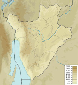
Kabuyenge Marsh (French: Marais de Kabuyenge; 2°31′05″S 30°19′53″E / 2.518°S 30.3315°E) is a marsh in the northwest of Kirundo Province, Burundi.
Location[edit]
The Kabuyenge stream flows north-northeast and forms the Kabuyenge Marsh in its lower reaches at the south end of Lake Kanzigiri, which lies just south of Lake Rweru. The marsh lies on the boundary between the Commune of Busoni and the Commune of Bwambarangwe, and is north of the town of Bwambarangwe.[1] The Köppen climate classification is Aw: Tropical savanna, wet.[2] The Kabuyenge Marsh and the Kabanga Marsh maintain the hydrological balance of Lake Kanzigiri. The United Nations Food and Agriculture Organization (FAO) had developed buffer zones around each of these marshes.[3]
Exploitation[edit]
Clay is extracted from the Kabuyenge marsh by some households to make bricks for construction.[4] A 2005 report stated that recent drought had forced the local people to use swampy areas for crops such as rice, sorghum, bananas and colocasia. There were rice crops upstream and downstream in the Kabanga and Kabuyenge marshes. The buffer zone of the Kabuyenge marsh was being destroyed over a length of about 100 metres (330 ft).[3]
References[edit]
Sources[edit]
- "Kabuyenge, Burundi", Mindat, retrieved 2024-06-18
- Nzigidahera, Benoît; Fofo, Alphonse; Misigaro, Apollinaire (August 2005), Paysage Aquatique Protege du Nord du Burundi – Etude D'identification (PDF) (in French), retrieved 9 June 2024
- "Way: Kabuyenge (224724039)", OpenStreetMap, retrieved 2024-06-17

