Kamyaran County
Appearance
Kamyaran County
Persian: شهرستان کامیاران | |
|---|---|
 Location of Kamyaran County in Kurdistan province (bottom, yellow) | |
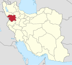
 Location of Kurdistan province in Iran | |
| Coordinates: 34°57′N 46°55′E / 34.950°N 46.917°E[1] | |
| Country | |
| Province | Kurdistan |
| Capital | Kamyaran |
| Districts | Central, Muchesh |
| Population (2016)[2] | |
• Total | 102,856 |
| Time zone | UTC+3:30 (IRST) |
| Kamyaran County can be found at GEOnet Names Server, at this link, by opening the Advanced Search box, entering "9206643" in the "Unique Feature Id" form, and clicking on "Search Database". | |
Kamyaran County (Persian: شهرستان کامیاران)[a] is in Kurdistan province, Iran. Its capital is the city of Kamyaran.[3]
Demographics
[edit]Population
[edit]At the time of the 2006 National Census, the county's population was 104,704 in 25,012 households.[4] The following census in 2011 counted 105,996 people in 28,508 households.[5] The 2016 census measured the population of the county as 102,856 in 30,276 households.[2]
Administrative divisions
[edit]Kamyaran County's population history and administrative structure over three consecutive censuses are shown in the following table.
| Administrative Divisions | 2006[4] | 2011[5] | 2016[2] |
|---|---|---|---|
| Central District | 73,820 | 77,394 | 80,941 |
| Bilavar RD | 5,484 | 6,360 | 6,903 |
| Shahu RD | 8,935 | 6,054 | 5,959 |
| Zhavehrud RD | 12,641 | 12,073 | 11,002 |
| Kamyaran (city) | 46,760 | 52,907 | 57,077 |
| Muchesh District | 30,884 | 28,602 | 21,915 |
| Amirabad RD | 7,330 | 6,518 | 5,517 |
| Avalan RD | 3,626 | 3,224 | 2,401 |
| Gavrud RD | 11,304 | 10,754 | 6,459 |
| Sursur RD | 5,674 | 4,658 | 4,168 |
| Muchesh (city) | 2,950 | 3,448 | 3,370 |
| Total | 104,704 | 105,996 | 102,856 |
| RD = Rural District | |||
See also
[edit]![]() Media related to Kamyaran County at Wikimedia Commons
Media related to Kamyaran County at Wikimedia Commons
Notes
[edit]References
[edit]- ^ OpenStreetMap contributors (27 December 2024). "Kamyaran County" (Map). OpenStreetMap (in Persian). Retrieved 27 December 2024.
- ^ a b c Census of the Islamic Republic of Iran, 1395 (2016): Kurdistan Province. amar.org.ir (Report) (in Persian). The Statistical Center of Iran. Archived from the original (Excel) on 8 May 2022. Retrieved 19 December 2022.
- ^ Habibi, Hassan (c. 2024) [Approved 11 December 1372]. Approval of reforms in Kurdistan province. solh.ir (Report) (in Persian). Ministry of the Interior, Political-Defense Commission of the Government Council. Archived from the original on 23 January 2024. Retrieved 23 January 2024 – via Iranian Knowledge Authority, Iranian Legal Authority (Civilika).
- ^ a b Census of the Islamic Republic of Iran, 1385 (2006): Kurdistan Province. amar.org.ir (Report) (in Persian). The Statistical Center of Iran. Archived from the original (Excel) on 20 September 2011. Retrieved 25 September 2022.
- ^ a b Census of the Islamic Republic of Iran, 1390 (2011): Kurdistan Province. irandataportal.syr.edu (Report) (in Persian). The Statistical Center of Iran. Archived from the original (Excel) on 19 January 2023. Retrieved 19 December 2022 – via Iran Data Portal, Syracuse University.

