Kawempe
Kawempe | |
|---|---|
| Coordinates: 00°22′45″N 32°33′27″E / 0.37917°N 32.55750°E | |
| Country | |
| Region | Central Uganda |
| District | Kampala Capital City Authority |
| Division | Kawempe Division |
| Time zone | UTC+3 (EAT) |
Kawempe is an area in the city of Kampala, Uganda's capital. It is also the location of the headquarters of Kawempe Division, one of the five administrative divisions of Kampala.
Location
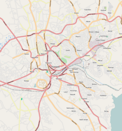
[edit]Kawempe is located on the northwestern edge of Kampala. It is bordered by Nabweru to the north, Kisaasi to the east, Bwaise to the south, Kazo to the southwest and Nansana in Wakiso District to the west. The road distance between Kampala's central business district and Kawempe is approximately 8.5 kilometres (5.3 mi).[1] The coordinates of Kawempe are:0°22'45.0"N 32°33'27.0"E (Latitude:0.3792; Longitude:32.5574).[2]
Overview
[edit]Kawempe lies on the main highway between Kampala and Masindi. It began as a trading center in the 1950s but has mushroomed into a busy, albeit disorganized, metropolitan area with businesses, small industries, retail shops and a thriving farmers market. Many of the surrounding villages have been turned into low income housing.
Points of interest
[edit]Kawempe hosts the following points of interests:
- Headquarters of Kawempe Division
- Bugisu Industries Limited - Manufactures packaging materials
- Harris International Stores
- Kawempe Muslim High School - One of the best in Uganda, academically[3]
- Headquarters of the Juma and Zukuli Muslim groups, one of the traditional Muslim sects in Uganda Islamic history.
- A branch of Bank of Africa (Uganda)
- A branch of Barclays Bank
- A branch of Bank of Baroda
- A branch of DFCU Bank
- A branch of Equity Bank
- A branch of Orient Bank - A member of the Bank PHB Group
- A branch of Stanbic Bank
- A branch of Opportunity Uganda Limited - A Tier II Financial Institution.[4]
- A branch of Pride Microfinance Limited - A Tier III Financial Institution
- Kawempe Central Market
- Kawempe General Hospital - A public hospital under the administration of the Uganda Ministry of Health - In development.
- The main factory and warehouse of the Aya Group, including a grain milling factory and a bakery.
- GELVIS STUDIOS: 100% Ugandan Film & Television Content Producer & Distributor.
- EWA MPERESE; COMMERCIAL Building housing SUPREME INVESTMENT PARTNERS, EXPRESS STEEL LTD, GELVIS STUDIOS & AS ENERGY PETRO STATION
- Supreme Investment Partners - Your Partner for Business Development and Finance services in Uganda
Notable Natives
[edit]- Joshua Baraka (born 2001), musician
See also
[edit]References
[edit]- ^ "Distance Between Central Kampala And Kawempe with Map". Globefeed.com. Retrieved 17 June 2014.
- ^ "Location of Kawempe At Google Maps". Google Maps. Retrieved 17 June 2014.
- ^ Bogere, Hussein; Kimbowa, Joseph (18 October 2012). "Fires, Strike Expose Rot At Kawempe Muslim School". The Observer (Uganda). Retrieved 17 June 2014.
- ^ Newvision, Archive (5 May 2009). "Faulu Goes to Kawempe". New Vision. Archived from the original on 10 May 2009. Retrieved 17 June 2014.


