Kleine Ohe (Danube)
Appearance
You can help expand this article with text translated from the corresponding article in German. (September 2011) Click [show] for important translation instructions.
|
| Kleine Ohe | |
|---|---|
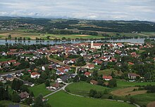
 The Kleine Ohe at Schöllnach | |
 | |
| Location | |
| Country | Germany |
| State | Bavaria |
| Physical characteristics | |
| Mouth | |
• location | Danube |
• coordinates | 48°39′49″N 13°07′49″E / 48.6636°N 13.1303°E |
| Length | 31.6 km (19.6 mi) [1] |
| Basin size | 85 km2 (33 sq mi) [1] |
| Basin features | |
| Progression | Danube→ Black Sea |
| River system | Danube |
Kleine Ohe (also: Schöllnach) is a river of Bavaria, Germany. It is a left tributary of the Danube near Hofkirchen.
The river also named Schöllnach, which rises near the Brotjacklriegel, drains the low mountain range to the south. It passes through several villages with similar names, such as Markt Schöllnach, Schöllnstein and the districts of Hofkirchen (Donau) Ober- and Unterschöllnach.

See also
[edit]References
[edit]- ^ a b Complete table of the Bavarian Waterbody Register by the Bavarian State Office for the Environment (xls, 10.3 MB)

