Lalín
Appearance
Lalín | |
|---|---|
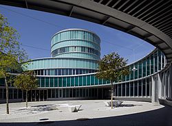
 City Hall | |
 Location of Lalín | |
| Coordinates: 42°39′N 8°7′W / 42.650°N 8.117°W | |
| Country | |
| Autonomous community | |
| Province | Pontevedra |
| Comarca | O Deza |
| Government | |
| • Alcalde | José Crespo (PPdeG) |
| Area | |
• Total | 326.83 km2 (126.19 sq mi) |
| Population (2018)[1] | |
• Total | 20,103 |
| • Density | 62/km2 (160/sq mi) |
| Demonym | Lalinense |
| Time zone | UTC+1 (CET) |
| • Summer (DST) | UTC+2 (CEST) |
| Postal code | 36500 |
| Website | www |
Lalín is a municipality in the north of the province of Pontevedra, in the autonomous community of Galicia, Spain. It is the capital of the comarca of O Deza.
The town has a population of 20,158 inhabitants (2014).[2] The surface of the municipality is 326.8 km2, being the biggest municipality in the province of Pontevedra and the fourth of Galicia, with a population density of 63.85 inhabitants/km2.
Located in the northeast of the province of Pontevedra; being bordered by Silleda and Vila de Cruces to the northwest, Forcarei to the west, Agolada and Rodeiro to the northeast, Dozón to the southeast and O Irixo to the south, all of them being part of the region of Deza, except O Irixo.
International relations
[edit]Twin towns – Sister cities
[edit] Cabeceiras de Basto, Portugal
 Lalinde, France
 Linden, Germany
 Linden (Cuijk), Netherlands
 Lubbeek, Belgium
 Sankt Georgen am Walde, Austria
References
[edit]- ^ Municipal Register of Spain 2018. National Statistics Institute.
- ^ http://www.ige.eu/igebdt/esq.jsp?paxina=002003001&c=-1&ruta=fichas%2Fbdmunicipal_tablas.jsp%3FESP%3D36024 Censo Lalín 2007
- ^ "Linden groet Linden" (in Dutch). Lubbeek. Retrieved 2020-01-03.
- ^ "Lalin (Espanha)" (in Portuguese). Cabeceiras de Basto. Retrieved 2020-05-28.


