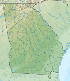
Little Satilla River (Atlantic Ocean)
Appearance
| Little Satilla River | |
|---|---|
| Location | |
| Country | United States |
| State | Georgia |
| Physical characteristics | |
| Source | |
| • location | Georgia |
| Mouth | |
• coordinates | 31°02′12″N 81°27′07″W / 31.03662°N 81.45204°W |
The Little Satilla River (formerly the St. Illa River)[1] is a 22.6-mile-long (36.4 km)[2] tidal river that forms the boundary between Glynn and Camden counties in the U.S. state of Georgia. It is a separate river from the Little Satilla River, 20 miles (32 km) to the northwest, which is a freshwater tributary of the Satilla River.[3][4]
The Rural Felicity Plantation formerly stood near the southern banks of the river.[5]
See also
[edit]References
[edit]- ^ Reminiscences of Charles Seton Henry Hardee, Martha Gallaudet Waring, The Georgia Historical Quarterly, JSTOR (1928), p. 167
- ^ U.S. Geological Survey. National Hydrography Dataset high-resolution flowline data. The National Map Archived 2012-03-29 at the Wayback Machine, accessed April 21, 2011
- ^ U.S. Geological Survey Geographic Names Information System: Little Satilla River
- ^ USGS Hydrologic Unit Map - State of Georgia (1974)
- ^ "Sankofagen Wiki / Rural Felicity". sankofagen.pbworks.com. Retrieved 2022-06-23.

