Lufthavnen station
Lufthavnen | |||||||||||
|---|---|---|---|---|---|---|---|---|---|---|---|
| Copenhagen Metro Station | |||||||||||
 | |||||||||||
| General information | |||||||||||
| Location | P-7 på Ellehammersvej, 2770 Kastrup Tårnby Municipality | ||||||||||
| Coordinates | 55°37′51″N 12°38′57″E / 55.63083°N 12.64917°E | ||||||||||
| Owned by | Metroselskabet | ||||||||||
| Platforms | 1 island platform | ||||||||||
| Tracks | 2 | ||||||||||
| Bus routes | |||||||||||
| Connections | |||||||||||
| Construction | |||||||||||
| Structure type | Elevated | ||||||||||
| Accessible | Yes | ||||||||||
| Other information | |||||||||||
| IATA code | CPH | ||||||||||
| Fare zone | 4 | ||||||||||
| History | |||||||||||
| Opened | 28 September 2007 | ||||||||||
| Services | |||||||||||
| |||||||||||
 | |||||||||||
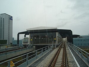
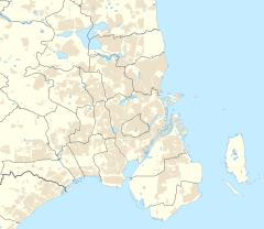
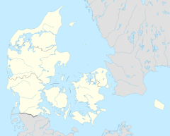
Lufthavnen station (Danish pronunciation: [ˈlɔftˌhɑwˀn stæˈɕoˀn]; The Airport Station) is a rapid transit station of the Copenhagen Metro, located at Copenhagen Airport on the island of Amager. The station is the terminus of the M2 line and is located in fare zone 4.
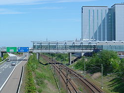
Trains approach the station by a bridge over the Øresund Motorway (E20). The platform area is constructed above the tracks of the Øresund Line adjoining a multi-storey car park. The station connects to the airport at the north end of Terminal 3 on level 2.
Intercity and regional trains operate out of the mainline Copenhagen Airport railway station which is located beneath the airport terminal building, around 200 metres (660 ft) from the Lufthavnen Station.

External links
[edit] Media related to Lufthavnen Station at Wikimedia Commons
- Lufthavnen Station on www.m.dk (in Danish)
- Lufthavnen Station on www.m.dk (in English)


