Malbork Voivodeship
| Malbork Voivodeship Województwo malborskie Palatinatus Marienburgensis | |||||||||||
|---|---|---|---|---|---|---|---|---|---|---|---|
| Voivodeship of Poland¹ Part of Royal Prussia and Greater Poland provinces | |||||||||||
| 1466–1772 | |||||||||||
 Malbork Voivodeship of the Polish–Lithuanian Commonwealth | |||||||||||
| Capital | Malbork | ||||||||||
| Area | |||||||||||
| • Coordinates | 54°02′21″N 19°01′39″E / 54.039205°N 19.027598°E | ||||||||||
• | 2,096 km2 (809 sq mi) | ||||||||||
| History | |||||||||||
• Prussian uprising | 1454 | ||||||||||
| 9 October 1466 | |||||||||||
| 1569 | |||||||||||
| 1772 | |||||||||||
| Political subdivisions | Counties: 4 | ||||||||||
| |||||||||||
| Today part of | Poland | ||||||||||
| ¹ Voivodeship of the Polish Crown in the Polish–Lithuanian Commonwealth; Voivodeship of the Kingdom of Poland before 1569. | |||||||||||
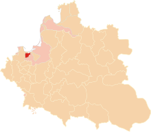
The Malbork Voivodeship (Polish: Województwo malborskie), after Partitions of Poland also referred to as the Malbork Land (Polish: Ziemia malborska), was a unit of administrative division and local government in the Kingdom of Poland from 1454/1466 until the Partitions of Poland in 1772–1795. Its capital was at Malbork.
Together with the Pomeranian and Chełmno Voivodeships and the Prince-Bishopric of Warmia it formed the historical province of Royal Prussia, and with several more voivodeships it formed part of the Greater Poland Province.
History
[edit]
| History of Brandenburg and Prussia |
|---|
  |
|
| Present |
|
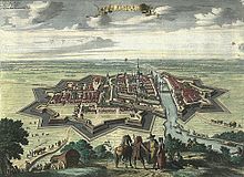
After the Teutonic Knights during the 13th century had conquered the Prussian territories and incorporated them into the Order's State, the castle of Marienburg served as the seat of the Grand Masters. Following the 1410 Battle of Grunwald, the Knights once again could withstand the Polish Siege of Marienburg. In 1440, various cities, towns and nobles from the area co-formed the anti-Teutonic Prussian Confederation.[1] In 1454, the organisation led an uprising against the rule of the Teutonic Knights, and asked King Casimir IV of Poland to include the region within the Kingdom of Poland, to which the King agreed and signed the act of incorporation of the region to Poland in March 1454 in Kraków,[2] which sparked the Thirteen Years' War. The cities of Elbląg, Malbork, Sztum and Tolkmicko were members of the Confederation,[3] whereas Dzierzgoń also sided with Poland in the war.[4] The Teutonic Knights had to withdraw from Malbork to Königsberg and after their final defeat lost the castle and the surrounding territory in the 1466 Second Peace of Thorn.
King Casimir IV Jagiellon of Poland established the Malbork Voivodeship, including the towns of Elbing (Elbląg), Stuhm (Sztum) and Christburg (Kiszpork/Dzierzgoń). Since the 1569 Union of Lublin the Lands of the Polish Crown were part of the larger Polish–Lithuanian Commonwealth. Malbork Castle was occupied twice by troops of the Swedish Empire: during the Thirty Years' War 1626–1629 and again from 1656 to 1660 during the Deluge. Truces between Poland and Sweden were signed in the Malbork Voivodeship in 1629 and 1635.
In 1772, the voivodeship was annexed by Prussia in the First Partition of Poland and became part of the newly established Province of West Prussia the next year.
Zygmunt Gloger in his monumental book Historical Geography of the Lands of Old Poland provides this description of Malbork Voivodeship:
"The smallest of three voivodeships of Polish Prussia, it was divided into four counties: Sztum, Kiszpork, Elbląg and Malbork. Local starostas resided at Kiszpork, Sztum, Tolkmicko, and other locations. Sejmiks and courts were not located at Malbork, but at Sztum, which itself was governed by the starosta of Kiszpork. At sejmiks, local nobility elected eight deputies to the Prussian Sejm, e.g. two from each county (...) Malbork Voivodeship’s coat of arms was almost identical as Chełmno Voivodeship's, with differences in color of the eagle. The Prussian Sejm took place alternatively at Malbork and Grudziądz".
Cities
[edit]

The largest city of the voivodeship was Elbląg, which as one of the largest and most influential cities of entire Poland enjoyed voting rights during the Royal free elections.[5] Other cities were Malbork, Sztum, Kiszpork, and Tolkmicko, and all cities in the voivodeship were royal cities of Poland.[6]
Administration
[edit]Voivodeship Governor (Wojewoda) seat:
Voivodes list:
- Ścibor Bażyński/Stibor (Tiburcius) von Baysen 15 June 1467 – 1480
- Mikołaj Bażyński/Niklas von Baysen 23 February 1481 – 27 March 1501
- Maciej Raba 21 August 1512 – 1546
- Achacy Czema 1546 – 24 May 1564
- Fabian Czema 1566–1580
- Fabian Czema (younger) 1581-22 August 1605
- Jerzy Kostka 1605–1611
- Stanisław Działyński 1611–1615
- Jan Wejher 1615–1618
- Stanisław Konarski 1618–1625
- Samuel Żaliński 3 November 1625 – 6 October 1629
- Samuel Konarski 30 November 1629 – 1641
- Mikołaj Wejher 11 October 1641 – 20 May 1643
- Jakub Wejher 20 May 1643 – 21 February 1657
- Stanisław Działyński 30 March 1657 – 1677
- Jan Ignacy Bąkowski 1677–1679
- Jan Gniński 1679
- Franciszek Jan Bieliński 1681–1685
- Ernest Denhoff 1685–1693
- Władysław Łoś 1694
- Jan Jerzy Przebendowski 17 September 1697 – 9 February 1703
- Piotr Kczewski 9 February 1703 – 20 November 1722
- Piotr Przebendowski 21 November 1722 – 1755
- Jakub Działyński 27 May 1756 – 17 September 1772
Regional council (sejmik generalny):
The Voivodeship was divided into four powiats (counties or administrative divisions):
- Sztum County, (Powiat Sztumski),
- Kiszpork County, (Powiat Kiszporski),
- Elbląg County, (Powiat Elbląski),
- Malbork County, (Powiat Malborski).
References
[edit]- ^ Górski 1949, p. XXXI.
- ^ Górski 1949, pp. 59–60.
- ^ Górski 1949, pp. XXXI, XXXVII–XXXVIII.
- ^ Słownik geograficzny Królestwa Polskiego i innych krajów słowiańskich, Tom II (in Polish). Warszawa. 1881. p. 281.
{{cite book}}: CS1 maint: location missing publisher (link) - ^ Polska encyklopedja szlachecka, Tom I (in Polish). Warszawa: Wydawnictwo Instytutu Kultury Historycznej. 1935. p. 42.
- ^ Prusy Królewskie w drugiej połowie XVI wieku. Część I. Mapy, plany (in Polish). Warszawa: Instytut Historii Polskiej Akademii Nauk. 2021. p. 1.
Sources
[edit]External links
[edit]Bibliography
[edit]- Górski, Karol (1949). Związek Pruski i poddanie się Prus Polsce: zbiór tekstów źródłowych (in Polish). Poznań: Instytut Zachodni.


