Melong, Cameroon
Appearance
Melong, Cameroon | |
|---|---|
 Drone view of the amazing Ekom Nkam waterfall | |
| Coordinates: 5°7′16″N 9°57′10″E / 5.12111°N 9.95278°E | |
| Country | |
| Region | South West |
| Department | Kupe-Manenguba |
| Elevation | 790 m (2,590 ft) |
| Population (2012) | |
• Total | 71,189 |
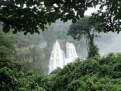
Melong is a community in Cameroon. It lies on the N5 road to the north of Nkongsamba. The soil is volcanic and fertile. The country around Melong was once covered by thick rainforest, the native population are Mbo'o, a group of Sawa people who are established in the Littoral and South West Region of the Country. The community is made up of many villages like Melong Center, Mouanguel, Mbouroukou, Mboussoum, Mankwa, and Nsanke. Melong is a volcanic area and very favorable for agriculture. From here it is possible to visit the twin Manengouba lakes, and waterfalls from Ekom on the River Nkam.
Gallery
[edit]-
Ekom Nkam Melong Falls
-
Ekom Nkam water Falls
-
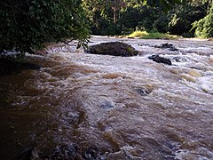
Ekom Nkam river
-
Ekom Nkam river
See also
[edit]References
[edit]Sources
- Kalu, Kelechi Amihe (2004). Agenda Setting and Public Policy in Africa. Ashgate Publishing, Ltd. ISBN 978-0-7546-3708-0. Retrieved 2012-07-30.
- Messina, Jean-Paul; Slageren, Jaap Van (2005). Histoire du christianisme au Cameroun: des origines à nos jours : approche oecuménique (in French). KARTHALA Editions. ISBN 978-2-84586-687-4. Retrieved 2012-07-30.
- Yerima, Bernard P.K.; Van Ranst, E. (2005). Major Soil Classification Systems Used in the Tropics:: Soils of Cameroon. Trafford Publishing. ISBN 978-1-4120-5789-9. Retrieved 2012-07-30.


