Menhir de Champ-Dolent
 | |
| Location | Brittany |
|---|---|
| Coordinates | 48°32′06″N 1°44′21″W / 48.5350°N 1.73917°W |
| Type | Menhir |
| History | |
| Periods | 5th millennium BC |
The Menhir de Champ-Dolent (French: [meniʁ də ʃɑ̃ dɔlɑ̃]; Breton: Maen-hir dolenn) is a menhir, or upright standing stone, located in a field outside the town of Dol-de-Bretagne. It is the second largest standing stone in Brittany and is over 9 metres high.
Location
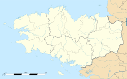
[edit]The Menhir du Champ-Dolent is 2 kilometres (1 mile) south of Dol-de-Bretagne in the department of Ille-et-Vilaine.[1][2] It is in a small picnic area fenced off among the fields near the D795 road.[3][4]
Description
[edit]The menhir is the second tallest of Brittany's standing stones.[1] Its height above ground is between 9.3 and 9.5 metres (about 31 feet).[5] It is made of pinkish granite,[4] quarried about 2.5 mi (4.0 km) away,[6] and has an estimated weight of around 100 tonnes.[5] It is oval in shape with a smooth surface.[2] A cross was once placed on top to Christianize it.[7] It is not precisely dated, but recent scholarship suggests that Brittany's menhirs were erected c. 5000–4000 BC.[8]
It has been registered as a monument historique by the French Ministry of Culture since 1889.[9]
In folklore
[edit]According to legend, the menhir rose from the ground to separate two feuding brothers who were on the point of killing each other.[3][7] This legend is said to account for the name "Champ Dolent" which means "Field of Sorrow".[1] In reality, the word dolent is more likely to derive from Breton dolenn ("meadow").[10]
Another legend states that the menhir is slowly sinking into the ground, and the world will end when it disappears altogether.[3]
According to tradition, in the year 560 Chlothar I, King of the Franks, is said to have met his rebel son, Chram, here.[11]
See also
[edit]References
[edit]- ^ a b c DK Eyewitness Travel Guide: Brittany: Brittany. Dorling Kindersley. 2013. p. 70. ISBN 978-1409331407.
- ^ a b Pozzi, Alberto (2014). Megalithism: Sacred and Pagan Architecture in Prehistory. Universal. p. 328. ISBN 978-1612332550.
- ^ a b c Ward, Greg (2003). Brittany and Normandy. Rough Guides. p. 235. ISBN 1843530767.
- ^ a b Barbour, Philippe (2005). Brittany. New Holland. p. 126. ISBN 1860111424.
- ^ a b Danze, Jean (2011). Le secret des menhirs: de Bretagne et d'ailleurs (in French). La Découvrance. p. 22. ISBN 978-2842657000.
- ^ Heath, Julian (November 15, 2019). Exploring Megalithic Europe: Amazing Sites to See for Yourself. Rowman & Littlefield. ISBN 9781538120927 – via Google Books.
- ^ a b Barbour, Philippe; Facaros, Dana; Pauls, Michael (2004). France. New Holland. p. 213. ISBN 186011881X.
- ^ Eyewitness, D. K. (June 1, 2017). DK Eyewitness Brittany. Dorling Kindersley Limited. ISBN 9780241452448 – via Google Books.
- ^ Base Mérimée: "Menhir de Champ Dolent", Ministère français de la Culture. (in French)
- ^ Celtic Culture: A-Celti. ABC-CLIO. July 27, 2006. ISBN 9781851094400 – via Google Books.
- ^ Spence, Lewis (1917). Legends and Romances of Brittany. Courier. p. 40.
External links
[edit]![]() Media related to Menhir du Champ Dolent at Wikimedia Commons
Media related to Menhir du Champ Dolent at Wikimedia Commons


