Mićkowa Hać
Appearance
Mićkowa Hać | |
|---|---|
Village | |
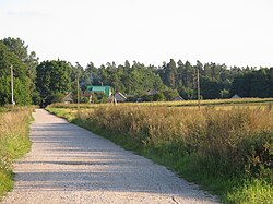
 Street of Mićkowa Hać | |
| Coordinates: 53°21′31″N 23°22′50″E / 53.35861°N 23.38056°E | |
| Country | |
| Voivodeship | Podlaskie |
| County | Sokółka |
| Gmina | Sokółka |
Mićkowa Hać [mit͡ɕˈkɔva ˈxat͡ɕ] is a village in the administrative district of Gmina Sokółka, within Sokółka County, Podlaskie Voivodeship, in north-eastern Poland, close to the border with Belarus.[1]
References
[edit]


