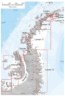
Muller Ice Shelf

Muller Ice Shelf, also known as Müller Ice Shelf[2] according to the original German spelling of the family name Müller, (67°15′S 66°52′W / 67.250°S 66.867°W) was an ice shelf lying southwest of Hooke Point in southwest Lallemand Fjord, Arrowsmith Peninsula, Loubet Coast. It was nurtured by Brückner Glacier and Antevs Glacier.
It collapsed "recently" (as at late March 2008).[3]
The name was given by United Kingdom Antarctic Place-Names Committee (UK-APC) in 1981 in memory of Fritz Muller (1926–80), a Swiss glaciologist, who carried out research in Switzerland, Greenland, the Canadian Arctic, and the Himalayas.
References
[edit]- ^ A. J. Cook; D. G. Vaughan (2009). "Ice shelf changes on the Antarctic Peninsula" (PDF). The Cryosphere Discussions. 3: 579–630. doi:10.5194/tcd-3-579-2009.
- ^ Gabrielle Walker:[Southern exposure https://www.newscientist.com/article/mg16321994.900-southern-exposure.html] in New Scientist, Nr. 2199, 14 August 1999
- ^ "Press Release - Antarctic ice shelf 'hangs by a thread'". National Environment Research Council. British Antarctic Survey. March 25, 2008. Retrieved 2009-03-20.
![]() This article incorporates public domain material from "Muller Ice Shelf". Geographic Names Information System. United States Geological Survey.
This article incorporates public domain material from "Muller Ice Shelf". Geographic Names Information System. United States Geological Survey.
