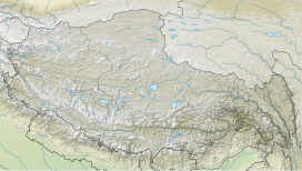
Naku La
Appearance
| Naku La (Laduo La) | |
|---|---|
| Elevation | 5,280 m (17,323 ft) |
| Location | India (Sikkim) – China (Tibet) |
| Range | Himalaya |
| Coordinates | 28°02′26″N 88°28′49″E / 28.04068°N 88.48020°E |
| Naku La | |||
|---|---|---|---|
| Traditional Chinese | 納庫拉山口 | ||
| Simplified Chinese | 纳库拉山口 | ||
| |||
Hindi - ना कु ला
Naku La(Chinese: 纳库拉山口) or Laduo La(Chinese: 拉多拉山口) is a mountain pass between Tibet Autonomous Region in China and Sikkim in India. Naku La has been a flashpoint for Indian and Chinese patrols and military infrastructure construction in the area.[1]
References
[edit]- ^ Kumar, Ankit (26 March 2021). "Exclusive: Satellite images show active Chinese posts near Sikkim's Naku La". India Today. Retrieved 2021-09-25.
Further reading
[edit]- O'Connor, W. F. (1900). Routes In Sikkim. Government Press, Calcutta.: Compiled in the Intelligence Branch of the Quartermaster General's Department in India. Office of the Superintendent of Government Printing, India. – via archive.org.
- Memoirs of the Geological Survey of India. Calcutta: Geological Survey of India. 1912 – via archive.org.


