Oteha
Oteha | |
|---|---|
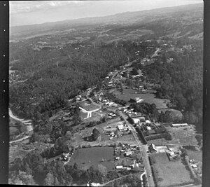
 Historic Aerial view of Oteha | |
 | |
| Coordinates: 36°43′05″S 174°43′01″E / 36.718°S 174.717°E | |
| Country | New Zealand |
| City | Auckland |
| Local authority | Auckland Council |
| Electoral ward | Albany ward |
| Local board | Upper Harbour Local Board |
| Area | |
| • Land | 129 ha (319 acres) |
| Population (June 2024)[2] | |
• Total | 5,850 |
| Postcode(s) | 0632 |
| Dairy Flat | Fairview Heights | Northcross |
| Albany |
|
Browns Bay |
| Albany | Pinehill | Rothesay Bay |
Oteha is an Auckland suburb, which is under local governance of Auckland Council. The area is defined by Oteha Valley Road on the north, East Coast Road on the east, Spencer Road on the south, and the Auckland Northern Motorway on the west.
Demographics
[edit]Oteha covers 1.29 km2 (0.50 sq mi)[1] and had an estimated population of 5,850 as of June 2024,[2] with a population density of 4,535 people per km2.
| Year | Pop. | ±% p.a. |
|---|---|---|
| 2006 | 3,033 | — |
| 2013 | 4,509 | +5.83% |
| 2018 | 5,112 | +2.54% |
| Source: [3] | ||
Oteha had a population of 5,112 at the 2018 New Zealand census, an increase of 603 people (13.4%) since the 2013 census, and an increase of 2,079 people (68.5%) since the 2006 census. There were 1,665 households, comprising 2,433 males and 2,679 females, giving a sex ratio of 0.91 males per female, with 1,023 people (20.0%) aged under 15 years, 1,155 (22.6%) aged 15 to 29, 2,391 (46.8%) aged 30 to 64, and 546 (10.7%) aged 65 or older.
Ethnicities were 37.0% European/Pākehā, 2.4% Māori, 1.5% Pacific peoples, 58.3% Asian, and 5.0% other ethnicities. People may identify with more than one ethnicity.
The percentage of people born overseas was 67.1, compared with 27.1% nationally.
Although some people chose not to answer the census's question about religious affiliation, 48.6% had no religion, 37.1% were Christian, 0.1% had Māori religious beliefs, 3.0% were Hindu, 2.0% were Muslim, 3.2% were Buddhist and 1.3% had other religions.
Of those at least 15 years old, 1,464 (35.8%) people had a bachelor's or higher degree, and 321 (7.9%) people had no formal qualifications. 654 people (16.0%) earned over $70,000 compared to 17.2% nationally. The employment status of those at least 15 was that 2,076 (50.8%) people were employed full-time, 555 (13.6%) were part-time, and 138 (3.4%) were unemployed.[3]
| Name | Area (km2) | Population | Density (per km2) | Households | Median age | Median income |
|---|---|---|---|---|---|---|
| Oteha East | 0.77 | 3,210 | 4169 | 1,098 | 35.5 years | $32,100[4] |
| Oteha West | 0.53 | 1,902 | 3589 | 567 | 32.7 years | $27,400[5] |
| New Zealand | 37.4 years | $31,800 |
Education
[edit]Oteha Valley School is a coeducational contributing primary school (years 1–6) with a roll of 533 students as at August 2024.[6][7] The school opened in 2004.[8]
City Impact Church School is a coeducational full primary (years 1–8) and a high school (years 9–13), with a roll of 343 primary and secondary students as at August 2024.[6][9][10] It is a private Christian school.[11]
Notes
[edit]- ^ a b "ArcGIS Web Application". statsnz.maps.arcgis.com. Retrieved 22 January 2024.
- ^ a b "Aotearoa Data Explorer". Statistics New Zealand. Retrieved 26 October 2024.
- ^ a b "Statistical area 1 dataset for 2018 Census". Statistics New Zealand. March 2020. Oteha East (117600) and Oteha West (117800).
- ^ 2018 Census place summary: Oteha East
- ^ 2018 Census place summary: Oteha West
- ^ a b "New Zealand Schools Directory". New Zealand Ministry of Education. Retrieved 17 September 2024.
- ^ Education Counts: Oteha Valley School
- ^ "Information Handbook" (DOC). Oteha Valley School. 13 June 2008. p. 1. Retrieved 7 February 2009.
- ^ Education Counts: City Impact Church School
- ^ Education Counts: City Impact Church School (Secondary)
- ^ "City Impact Church School - About Us". City Impact Church. Retrieved 21 July 2019.
