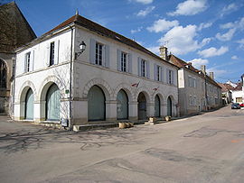
Ouanne
Ouanne | |
|---|---|
 Town hall | |
| Coordinates: 47°39′45″N 3°25′09″E / 47.66250°N 3.4192°E | |
| Country | France |
| Region | Bourgogne-Franche-Comté |
| Department | Yonne |
| Arrondissement | Auxerre |
| Canton | Vincelles |
| Government | |
| • Mayor (2020–2026) | Catherine Cordier[1] |
Area 1 | 38.20 km2 (14.75 sq mi) |
| Population (2021)[2] | 589 |
| • Density | 15/km2 (40/sq mi) |
| Time zone | UTC+01:00 (CET) |
| • Summer (DST) | UTC+02:00 (CEST) |
| INSEE/Postal code | 89283 /89560 |
| Elevation | 226–371 m (741–1,217 ft) (avg. 314 m or 1,030 ft) |
| 1 French Land Register data, which excludes lakes, ponds, glaciers > 1 km2 (0.386 sq mi or 247 acres) and river estuaries. | |
Ouanne (French pronunciation: [wan]) is a commune in the Yonne department in Bourgogne-Franche-Comté in north-central France,[3] in the natural region of Forterre.
History
[edit]Ouanne existed in Gallo-Roman times under the name of Odouna or Oduna. A Roman way carried out in Auxerre.[clarification needed] The ancient station of Ouanne is known from a marble fragment from the 3rd century, preserved at the museum of Autun. The marble indicates the distances on the Roman road from Auxerre to Entrains-sur-Nohain. The armies of Pippin the Younger passed along this road.
In 1790, Ouanne became the chief town of its canton, but the number of cantons was subsequently reduced and the village became attached to Courson-les-Carrières. In December 1972, Ouanne was merged with Merry-Sec and Chastenay. In January 1980, Merry-Sec became a separate commune again.[4]
Geography
[edit]The river Ouanne, a 84 km (52 mi) long right tributary of the Loing, has its source in the commune.
Demography
[edit]Inhabitants of Ouanne are known as Ouannais.
|
| |||||||||||||||||||||||||||||||||||||||||||||
| Source: EHESS[4] and INSEE (1968-2017)[5] | ||||||||||||||||||||||||||||||||||||||||||||||
Places and monuments
[edit]- Notre-Dame Church (15th-16th centuries), blazing style, entirely arched
- Source de l'Ouanne (built in 1867), close to the laundrette
- Castle of the Mines (16th century)
Personalities
[edit]See also
[edit]References
[edit]- ^ "Répertoire national des élus: les maires" (in French). data.gouv.fr, Plateforme ouverte des données publiques françaises. 13 September 2022.
- ^ "Populations légales 2021" (in French). The National Institute of Statistics and Economic Studies. 28 December 2023.
- ^ Commune d'Ouanne (89283), INSEE
- ^ a b Des villages de Cassini aux communes d'aujourd'hui: Commune data sheet Ouanne, EHESS (in French).
- ^ Population en historique depuis 1968, INSEE


