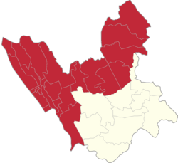
Palasan, Valenzuela
Appearance
Palasan | |
|---|---|
 Palasan Barangay Complex | |
 | |
| Coordinates: 14°42′10″N 120°56′49″E / 14.70278°N 120.94694°E | |
| Country | |
| Region | National Capital Region |
| City | Valenzuela |
| Congressional districts | Part of the 1st district of Valenzuela |
| Government | |
| • Barangay Chairman | Evelina D. Alejandrino |
| Area | |
• Total | 0.156 km2 (0.060 sq mi) |
| Population (2007) | |
• Total | 5,195 |
| • Density | 33,000/km2 (86,000/sq mi) |
| ZIP code | 1444 |
| Area code | 2 |
Palasan is one of the constituent barangays in the city of Valenzuela, Metro Manila, Philippines.[1]
Festivals
[edit]Palasan celebrates its fiesta every first Sunday of May for their patron saint, Sta. Cruz.
Landmarks
[edit]

Establishments in the area include the Pio Valenzuela Elementary School, Polo National High School and San Diego de Alcala Parish Church, and Palasan River.
As of today, a lot of business establishments build around the vicinity, which are:
Lasam's Diner Kubyertos TeaTone PresidenTea Rapsa Ramen Eboy's Manok Andok's Chooks-to-Go Yin Yang Milk Tea Juancibo & Gungjeon
References
[edit]- ^ Valenzuela; Palasan, Valenzuela Retrieved on September 22, 2012
External links
[edit]- Valenzuela, Philippines official site
 Media related to Palasan at Wikimedia Commons


