Panhauna
Panhauna | |
|---|---|
Village | |
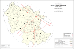
 Map showing Panhauna (#028) in Singhpur CD block | |
| Coordinates: 26°29′12″N 81°27′29″E / 26.486546°N 81.457966°E[1] | |
| Country India | |
| State | Uttar Pradesh |
| District | Raebareli |
| Area | |
• Total | 8.907 km2 (3.439 sq mi) |
| Population (2011)[2] | |
• Total | 7,075 |
| • Density | 790/km2 (2,100/sq mi) |
| Languages | |
| • Official | Hindi |
| Time zone | UTC+5:30 (IST) |
| PIN | 229308[2] |
| Vehicle registration | UP-35 |
Panhauna is a village in Singhpur block of Rae Bareli district, Uttar Pradesh, India.[2] As of 2011, its population is 7,075, in 1,307 households.[2] It has one primary school and no healthcare facilities.[2]
History
[edit]Panhauna was historically the seat of a taluqdari estate held by a branch of the Bais Rajputs.[3] This family belonged to the Gaumaha or Gandeo subdivision of the broader Kath Bais tribe and supposedly came to the area from Gahu Munj near Delhi sometime around the year 1300.[3] Under their leader, Banar Sah, they conquered the Bhars and Dhobis in the area.[3] Banar Sah had 6 sons who divided the original lands between them, and the Panhauna taluqdars were descended from the eldest, Raja Rawat.[3]
The 1961 census recorded Panhauna as comprising 20 hamlets, with a total population of 2,587 people (1,303 male and 1,284 female), in 599 households and 585 physical houses.[4] The area of the village was given as 2,269 acres and it had a post office at that point.[4]
The 1981 census recorded Panhauna as having a population of 3,727 people, in 786 households, and having an area of 910.54 hectares.[5] The main staple foods are wheat and rice.[5]
References
[edit]- ^ "GeoNames Search". geonames.nga.mil. Archived from the original on 12 April 2014.
- ^ a b c d e f "Census of India 2011: Uttar Pradesh District Census Handbook – Rae Bareli, Part A (Village and Town Directory)" (PDF). Census 2011 India. pp. 125–41. Retrieved 31 July 2021.
- ^ a b c d Nevill, H.R. (1905). Rai Bareli: A Gazetteer, Being Volume XXXIX Of The District Gazetteers Of The United Provinces Of Agra And Oudh. Allahabad: Government Press. pp. 80–1. Retrieved 31 July 2021.
- ^ a b Census 1961: District Census Handbook, Uttar Pradesh (39 – Raebareli District) (PDF). Lucknow. 1965. pp. xx-xxi of section "Maharajganj Tahsil". Retrieved 31 July 2021.
{{cite book}}: CS1 maint: location missing publisher (link) - ^ a b Census 1981 Uttar Pradesh: District Census Handbook Part XIII-A: Village & Town Directory, District Rae Bareli (PDF). 1982. pp. 48–9. Retrieved 31 July 2021.

