Phagres

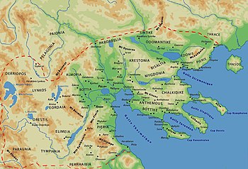
Phagres (Ancient Greek: Φάγρης) was a Greek[1] city located in ancient Thrace and later in Macedon, in the region between the river Strymon and the river Nestos called Edonis or Pieris.[2][3][4] It was founded by colonists from Thasos.[5] It was perhaps together with Galepsus and Apollonia occupied and destroyed by Philip II of Macedon after the capture of Amphipolis. Despite this, archeological remains include Hellenistic finds and indications that Phagres survived into the Roman period.[1]
Its site is located near modern Orfani (Orphanion).[6][7]
See also
[edit]References
[edit]- ^ a b Mogens Herman Hansen & Thomas Heine Nielsen (2004). An inventory of archaic and classical poleis. New York: Oxford University Press. p. 865. ISBN 0-19-814099-1.
- ^ Herodotus. Histories. Vol. 7.112.
- ^ Thucydides. History of the Peloponnesian War. Vol. 2.99.
- ^ Periplus of Pseudo-Scylax, 68; Strabo. Geographica. Vol. vii., Fr. 33, p. 331. Page numbers refer to those of Isaac Casaubon's edition.
- ^ [1] Archived 2017-04-24 at the Wayback Machine D. C. Samsaris, Historical Geography of Eastern Macedonia during the Antiquity (in Greek), Thessaloniki 1976 (Society for Macedonian Studies), p. 160-161. ISBN 960-7265-16-5
- ^ Richard Talbert, ed. (2000). Barrington Atlas of the Greek and Roman World. Princeton University Press. p. 51, and directory notes accompanying. ISBN 978-0-691-03169-9.
- ^ Lund University. Digital Atlas of the Roman Empire.
![]() This article incorporates text from a publication now in the public domain: Smith, William, ed. (1854–1857). "Phagres". Dictionary of Greek and Roman Geography. London: John Murray.
This article incorporates text from a publication now in the public domain: Smith, William, ed. (1854–1857). "Phagres". Dictionary of Greek and Roman Geography. London: John Murray.
40°46′21″N 23°57′32″E / 40.772449°N 23.95895°E
