Pleasant Peak
Appearance
| Pleasant Peak | |
|---|---|
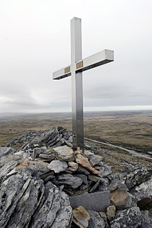
 The memorial on Pleasant Peak | |
| Highest point | |
| Coordinates | 51°46′55.85″S 58°28′22.13″W / 51.7821806°S 58.4728139°W |
| Geography | |
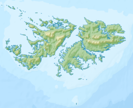
Pleasant Peak is a location on the Falkland Islands, East Falkland, two miles (3.2 km) north of RAF Mount Pleasant.[1]
History
[edit]
The mountain was the site of the 1982 British Army Gazelle friendly fire incident when HMS Cardiff shot down a British Army Gazelle helicopter, killing its four occupants.[2]
When the adjacent Mount Pleasant Complex was being constructed in the aftermath of the Falkland conflict, a quarry was opened up on the lower slopes of Pleasant Peak to supply hard rock (quartzite) for the construction of the foundations and a base for the runway.[3]
References
[edit]- ^ "View from Pleasant Peak - Falkland Islands". www.british-towns.net. Retrieved 3 May 2008.
- ^ Ranter, Harro. "Westland Gazelle AH1 XX377 accident, 6 Jun 1982". aviation-safety.net. Retrieved 24 September 2017.
- ^ Aldis, E. T.; Edwards, D. J. (1999). "The Geology of the Falkland Islands" (PDF). nerc.ac.uk. British Geological Survey. p. 208. Retrieved 24 September 2017.


