Poltava International Airport
Poltava International Airport Аеропорт «Полтава» | |||||||||||
|---|---|---|---|---|---|---|---|---|---|---|---|
 | |||||||||||
| Summary | |||||||||||
| Airport type | Public | ||||||||||
| Serves | Poltava | ||||||||||
| Location | Suprunivka, Poltava Oblast, Ukraine | ||||||||||
| Coordinates | 49°34′26″N 034°23′55″E / 49.57389°N 34.39861°E | ||||||||||
| Map | |||||||||||
 | |||||||||||
| Runways | |||||||||||
| |||||||||||
 | |||||||||||
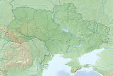
Poltava International Airport (Ukrainian: Аеропорт «Полтава» (Супрунівка)) (IATA: PLV, ICAO: UKHP) is a public airport located approximately 7 kilometres (4.3 mi) west of Poltava, Ukraine. It is one of two airfields near Poltava, the other being Poltava Airbase. The airport is located near the villages Ivashky (Ukrainian: Івашки) and Suprunivka (Ukrainian: Супрунівка). Since 2020 the airport is closed due to reconstruction.[1]
History
[edit]Built in 1924, Poltava International airport was once able to process 200 passengers per hour. It took 2 years to build a new terminal, which was opened in 1974. In its best times from 40 to 60 planes used to land here. Back then it employed around 900 people.[2]
Airlines and destinations
[edit]Since 2020 the airport is closed due to reconstruction.[1]
See also
[edit]References
[edit]- ^ a b (in Ukrainian) The plane with deputies of OPZZh asked to land in Poltava, passengers weren't released, Ukrayinska Pravda (3 September 2021)
(in Ukrainian) About UAH 200 million is needed to restore Poltava airport, depo.ua (3 January 2020) - ^ "Poltava Airport - Is there one?". poltavatravel.com.

